

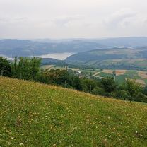
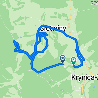
Śladami maratonów MTB *** Krynica dystans GIGA
A cycling route starting in Krynica-Zdrój, Lesser Poland Voivodeship, Poland.
Overview
About this route
- -:--
- Duration
- 66.6 km
- Distance
- 1,923 m
- Ascent
- 1,923 m
- Descent
- ---
- Avg. speed
- ---
- Max. altitude

Continue with Bikemap
Use, edit, or download this cycling route
You would like to ride Śladami maratonów MTB *** Krynica dystans GIGA or customize it for your own trip? Here is what you can do with this Bikemap route:
Free features
- Save this route as favorite or in collections
- Copy & plan your own version of this route
- Sync your route with Garmin or Wahoo
Premium features
Free trial for 3 days, or one-time payment. More about Bikemap Premium.
- Navigate this route on iOS & Android
- Export a GPX / KML file of this route
- Create your custom printout (try it for free)
- Download this route for offline navigation
Discover more Premium features.
Get Bikemap PremiumFrom our community
Other popular routes starting in Krynica-Zdrój
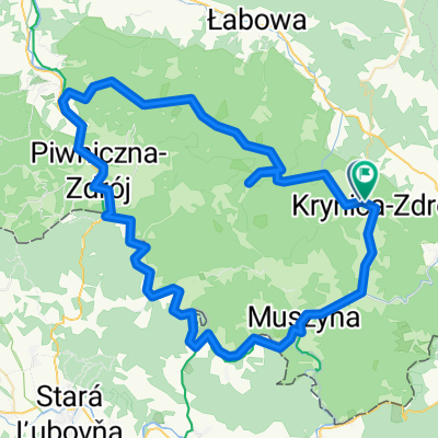
 Lengthy bike tour from Krynica-Zdrój to Świniarsko
- Distance
- 56.3 km
- Ascent
- 664 m
- Descent
- 927 m
- Location
- Krynica-Zdrój, Lesser Poland Voivodeship, Poland
 Krynica - Muszyna - Krynica - 14 sierpnia, 10:25
- Distance
- 29 km
- Ascent
- 191 m
- Descent
- 221 m
- Location
- Krynica-Zdrój, Lesser Poland Voivodeship, Poland
 Szkolna do Szkolna
- Distance
- 56.8 km
- Ascent
- 1,191 m
- Descent
- 1,227 m
- Location
- Krynica-Zdrój, Lesser Poland Voivodeship, Poland
 Szkolna do Książenicka 54A
- Distance
- 276.9 km
- Ascent
- 1,742 m
- Descent
- 2,142 m
- Location
- Krynica-Zdrój, Lesser Poland Voivodeship, Poland
 Zielona do Zielona 20A
- Distance
- 11.5 km
- Ascent
- 337 m
- Descent
- 376 m
- Location
- Krynica-Zdrój, Lesser Poland Voivodeship, Poland
 Zielona do Zielona
- Distance
- 82.4 km
- Ascent
- 1,527 m
- Descent
- 1,559 m
- Location
- Krynica-Zdrój, Lesser Poland Voivodeship, Poland
 Szkolna do Szkolna
- Distance
- 2.7 km
- Ascent
- 100 m
- Descent
- 124 m
- Location
- Krynica-Zdrój, Lesser Poland Voivodeship, Poland
 Bulwary Dietla 21A do Szkolna
- Distance
- 3.2 km
- Ascent
- 86 m
- Descent
- 79 m
- Location
- Krynica-Zdrój, Lesser Poland Voivodeship, Poland
Open it in the app