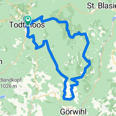
Todtmoos
- 38.2 km
- 321 m
- 797 m
- Todtmoos, Baden-Wurttemberg, Germany
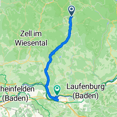
Torino - Foresta Nera
A cycling route starting in Todtmoos, Baden-Wurttemberg, Germany.
Overview
Todtmoos - Wolfisberg. 6th Stage of Turin - Black Forest
created this 12 years ago
Part of
9 stages
Route quality
Road
9.7 km
(11 %)
Quiet road
6.2 km
(7 %)
Paved
79.3 km
(90 %)
Unpaved
0.9 km
(1 %)
Asphalt
78.5 km
(89 %)
Paved (undefined)
0.9 km
(1 %)
Continue with Bikemap
You would like to ride Torino - Foresta Nera: Giorno 6: Todtmoos - Wolfisberg or customize it for your own trip? Here is what you can do with this Bikemap route:
Free trial for 3 days, or one-time payment. More about Bikemap Premium.
Discover more Premium features.
Get Bikemap PremiumFrom our community
Open it in the app