

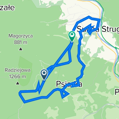
Śladami Rogasia z Doliny Roztoki Ryterskiej
A cycling route starting in Rytro, Lesser Poland Voivodeship, Poland.
Overview
About this route
Śladami Rogasia z Doliny Roztoki
Nowy Sącz –Roztoka Ryterska (samochodem) – Roztoka Wielka – Wdżary Wyżne – Wietrzne Dziury – Wielka Przehyba – Złomisty Wierch – Przełęcz Żłobki – Jaworzyny - Roztoka Ryterska - Nowy Sącz- -:--
- Duration
- 23.2 km
- Distance
- 960 m
- Ascent
- 977 m
- Descent
- ---
- Avg. speed
- ---
- Max. altitude

Continue with Bikemap
Use, edit, or download this cycling route
You would like to ride Śladami Rogasia z Doliny Roztoki Ryterskiej or customize it for your own trip? Here is what you can do with this Bikemap route:
Free features
- Save this route as favorite or in collections
- Copy & plan your own version of this route
- Sync your route with Garmin or Wahoo
Premium features
Free trial for 3 days, or one-time payment. More about Bikemap Premium.
- Navigate this route on iOS & Android
- Export a GPX / KML file of this route
- Create your custom printout (try it for free)
- Download this route for offline navigation
Discover more Premium features.
Get Bikemap PremiumFrom our community
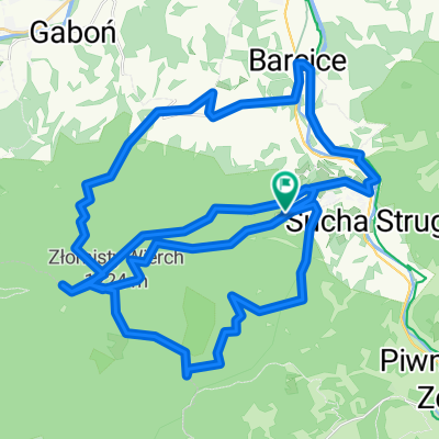
Other popular routes starting in Rytro
 Rytro Stara Lubovna
- Distance
- 27.5 km
- Ascent
- 585 m
- Descent
- 398 m
- Location
- Rytro, Lesser Poland Voivodeship, Poland
 Rytro - Cyrla - Makowica
- Distance
- 13.1 km
- Ascent
- 610 m
- Descent
- 609 m
- Location
- Rytro, Lesser Poland Voivodeship, Poland
 Enduro Przehyba 2017 #2
- Distance
- 39.9 km
- Ascent
- 1,711 m
- Descent
- 999 m
- Location
- Rytro, Lesser Poland Voivodeship, Poland
 Wielki Rogacz Beskid Sądecki
- Distance
- 24 km
- Ascent
- 621 m
- Descent
- 896 m
- Location
- Rytro, Lesser Poland Voivodeship, Poland
 Radziejowa czerwonym
- Distance
- 21.4 km
- Ascent
- 867 m
- Descent
- 867 m
- Location
- Rytro, Lesser Poland Voivodeship, Poland
 PASMO RADZIEJOWEJ - BESKID SĄDECKI 2016.04.23
- Distance
- 62.1 km
- Ascent
- 1,591 m
- Descent
- 1,593 m
- Location
- Rytro, Lesser Poland Voivodeship, Poland
 Przehyba Enduro 2
- Distance
- 56.4 km
- Ascent
- 1,762 m
- Descent
- 1,760 m
- Location
- Rytro, Lesser Poland Voivodeship, Poland
 Rytro Pętla
- Distance
- 104.8 km
- Ascent
- 1,635 m
- Descent
- 1,539 m
- Location
- Rytro, Lesser Poland Voivodeship, Poland
Open it in the app