

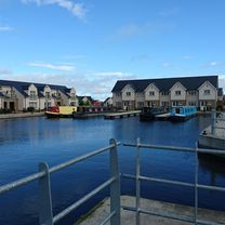
Gladhouse Reservoir
A cycling route starting in Edinburgh, Scotland, United Kingdom.
Overview
About this route
rough track between Capielaw (2 km NW of Carrington) and Whitehill House - approx. 1.5 km; can be avoided by turning left at the first crossroad after Carrington and following the road round to just south of Rosewell.
THE HILL at Polton ... enough said!- -:--
- Duration
- 55.7 km
- Distance
- 384 m
- Ascent
- 384 m
- Descent
- ---
- Avg. speed
- ---
- Max. altitude
Route quality
Waytypes & surfaces along the route
Waytypes
Road
21.2 km
(38 %)
Quiet road
11.7 km
(21 %)
Surfaces
Paved
53.4 km
(96 %)
Unpaved
1.1 km
(2 %)
Asphalt
53.4 km
(96 %)
Gravel
0.6 km
(1 %)
Continue with Bikemap
Use, edit, or download this cycling route
You would like to ride Gladhouse Reservoir or customize it for your own trip? Here is what you can do with this Bikemap route:
Free features
- Save this route as favorite or in collections
- Copy & plan your own version of this route
- Sync your route with Garmin or Wahoo
Premium features
Free trial for 3 days, or one-time payment. More about Bikemap Premium.
- Navigate this route on iOS & Android
- Export a GPX / KML file of this route
- Create your custom printout (try it for free)
- Download this route for offline navigation
Discover more Premium features.
Get Bikemap PremiumFrom our community
Other popular routes starting in Edinburgh
 waking up the mumbsculls
- Distance
- 37.5 km
- Ascent
- 208 m
- Descent
- 210 m
- Location
- Edinburgh, Scotland, United Kingdom
 Polwarth to Craigmillar castle. And back!
- Distance
- 14.2 km
- Ascent
- 201 m
- Descent
- 192 m
- Location
- Edinburgh, Scotland, United Kingdom
 Edinburgh-Rosewell Route
- Distance
- 33.4 km
- Ascent
- 331 m
- Descent
- 331 m
- Location
- Edinburgh, Scotland, United Kingdom
 Edinburgh - Ormiston - Pathead - Crichton Castle - Arniston - home
- Distance
- 59.8 km
- Ascent
- 419 m
- Descent
- 419 m
- Location
- Edinburgh, Scotland, United Kingdom
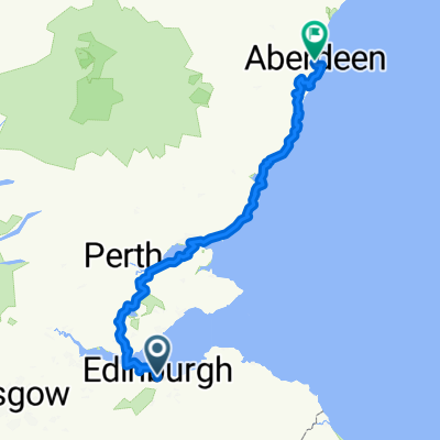 Sco03 Edinburgh-Aberdeen
- Distance
- 254.7 km
- Ascent
- 1,169 m
- Descent
- 1,226 m
- Location
- Edinburgh, Scotland, United Kingdom
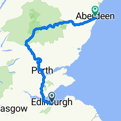 High Street to Union Street
- Distance
- 303.9 km
- Ascent
- 3,256 m
- Descent
- 3,319 m
- Location
- Edinburgh, Scotland, United Kingdom
 106KM Edinburgh
- Distance
- 107.1 km
- Ascent
- 532 m
- Descent
- 527 m
- Location
- Edinburgh, Scotland, United Kingdom
 westward bound circuit 07/10/17
- Distance
- 38.9 km
- Ascent
- 235 m
- Descent
- 241 m
- Location
- Edinburgh, Scotland, United Kingdom
Open it in the app