
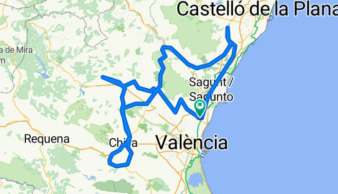
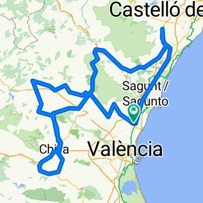
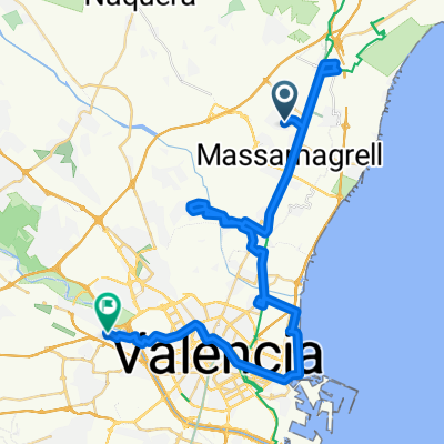
Brevet Randonneur 300K Massamagrell
A cycling route starting in Massamagrell, Valencia, Spain.
Overview
About this route
Brevet Randonneur 300K Massamagrell
- -:--
- Duration
- 282.7 km
- Distance
- 3,014 m
- Ascent
- 3,015 m
- Descent
- ---
- Avg. speed
- ---
- Max. altitude

Route quality
Waytypes & surfaces along the route
Waytypes
Road
101.8 km
(36 %)
Quiet road
42.4 km
(15 %)
Surfaces
Paved
48.1 km
(17 %)
Asphalt
45.2 km
(16 %)
Paved (undefined)
2.8 km
(1 %)
Undefined
234.6 km
(83 %)
Continue with Bikemap
Use, edit, or download this cycling route
You would like to ride Brevet Randonneur 300K Massamagrell or customize it for your own trip? Here is what you can do with this Bikemap route:
Free features
- Save this route as favorite or in collections
- Copy & plan your own version of this route
- Split it into stages to create a multi-day tour
- Sync your route with Garmin or Wahoo
Premium features
Free trial for 3 days, or one-time payment. More about Bikemap Premium.
- Navigate this route on iOS & Android
- Export a GPX / KML file of this route
- Create your custom printout (try it for free)
- Download this route for offline navigation
Discover more Premium features.
Get Bikemap PremiumFrom our community
Other popular routes starting in Massamagrell
 DE SOL A SOL 2011
- Distance
- 153.6 km
- Ascent
- 1,011 m
- Descent
- 1,007 m
- Location
- Massamagrell, Valencia, Spain
 Brevet Randonneur 1000K Massamagrell 2013
- Distance
- 967.8 km
- Ascent
- 1,918 m
- Descent
- 1,916 m
- Location
- Massamagrell, Valencia, Spain
 via xurra a Serra
- Distance
- 22.1 km
- Ascent
- 840 m
- Descent
- 432 m
- Location
- Massamagrell, Valencia, Spain
 BREVET 200. POR BETXI-ALTURA-PEDRALBA
- Distance
- 200 km
- Ascent
- 965 m
- Descent
- 965 m
- Location
- Massamagrell, Valencia, Spain
 BREVET 300-BUGARRA
- Distance
- 295.4 km
- Ascent
- 1,390 m
- Descent
- 1,390 m
- Location
- Massamagrell, Valencia, Spain
 COVA SANTA PER EL PICO AGUILA
- Distance
- 127.5 km
- Ascent
- 1,218 m
- Descent
- 1,218 m
- Location
- Massamagrell, Valencia, Spain
 VUELTA SUBE-BAJA
- Distance
- 212 km
- Ascent
- 1,710 m
- Descent
- 1,709 m
- Location
- Massamagrell, Valencia, Spain
 Rafelbunyol - Quart (50 Km)
- Distance
- 53.9 km
- Ascent
- 225 m
- Descent
- 208 m
- Location
- Massamagrell, Valencia, Spain
Open it in the app