Chipping Norton mit dem Fahrrad
Entdecke eine Karte mit 102 Radrouten und Radwegen rund um Chipping Norton, erstellt von unserer Community.
Regionenporträt
Lerne Chipping Norton kennen
Finde die richtige Fahrradroute in Chipping Norton, wo wir 102 Fahrradrouten für dich zum Erkunden haben. Die meisten Leute fahren hier in den Monaten April und Juli Fahrrad.
4.665 km
Aufgezeichnete Strecken
102
Fahrradrouten
5.815
Einwohner
Community
Die aktivsten Nutzer in Chipping Norton
Von unserer Community
Die besten Fahrradrouten in und um Chipping Norton


New Way of the Rings Chipping Norton to Marlborough
Fahrradtour in Chipping Norton, England, Vereinigtes Königreich
- 93 km
- Distanz
- 633 m
- Aufstieg
- 704 m
- Abstieg
Moreton in Marsh loop
Fahrradtour in Chipping Norton, England, Vereinigtes Königreich
- 40,8 km
- Distanz
- 324 m
- Aufstieg
- 320 m
- Abstieg
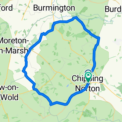
Chipping Norton - Moreton-in-Marsh
Fahrradtour in Chipping Norton, England, Vereinigtes Königreich
- 38 km
- Distanz
- 401 m
- Aufstieg
- 401 m
- Abstieg
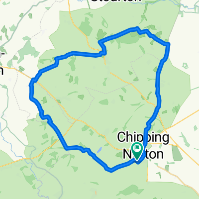
Chipping Norton - Stow
Fahrradtour in Chipping Norton, England, Vereinigtes Königreich
- 37,6 km
- Distanz
- 340 m
- Aufstieg
- 340 m
- Abstieg
Mehr Routen entdecken
- Alle Routen in Chipping Norton
- Rundwege
- Entspannt
- Gravel
- Rennrad
- MTB
- Trekking


 The Green, Kingham to Corn Exchange0
- 41,9 km
- 330 m
- 322 m
- Chipping Norton, England, Vereinigtes Königreich


 The Green, Kingham to Corn Exchange0
- 41,9 km
- 330 m
- 322 m
- Chipping Norton, England, Vereinigtes Königreich