Castor mit dem Fahrrad
Entdecke eine Karte mit 151 Radrouten und Radwegen rund um Castor, erstellt von unserer Community.
Regionenporträt
Lerne Castor kennen
Finde die richtige Fahrradroute in Castor, wo wir 151 Fahrradrouten für dich zum Erkunden haben. Die meisten Leute fahren hier in den Monaten Juni und Juli Fahrrad.
6.420 km
Aufgezeichnete Strecken
151
Fahrradrouten
Handverlesene Routen
Entdecke Castor durch diese Sammlungen
Von unserer Community
Die besten Fahrradrouten in und um Castor
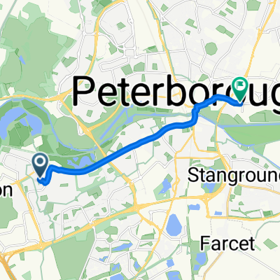
home to work
Fahrradtour in Castor, England, Vereinigtes Königreich
- 8,9 km
- Distanz
- 13 m
- Aufstieg
- 23 m
- Abstieg
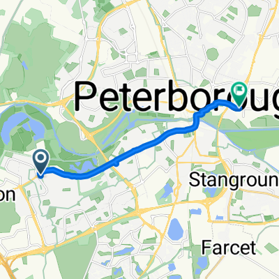
water crescent to Lynch Wood
Fahrradtour in Castor, England, Vereinigtes Königreich
- 34,8 km
- Distanz
- 182 m
- Aufstieg
- 185 m
- Abstieg
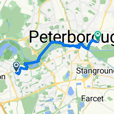
Restful ride in Oundle
Fahrradtour in Castor, England, Vereinigtes Königreich
- 63,7 km
- Distanz
- 646 m
- Aufstieg
- 622 m
- Abstieg
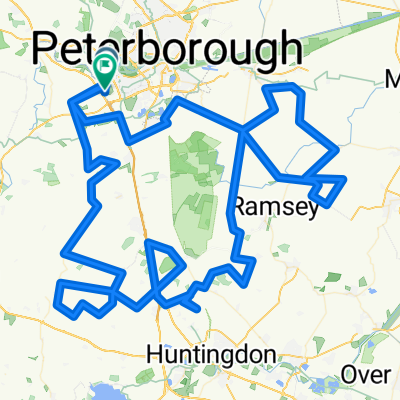
Peterborough Classic
Fahrradtour in Castor, England, Vereinigtes Königreich
- 102,9 km
- Distanz
- 467 m
- Aufstieg
- 468 m
- Abstieg
Mehr Routen entdecken
- Alle Routen in Castor
- Rundwege
- Entspannt
- Gravel
- Rennrad
- MTB
- Trekking


 Marholm Loop: Orton Goldhay Longueville Longthorpe Hospital Bretton Milton Gunwade Nene Park Wistow Brimbles1
- 20,1 km
- 70 m
- 69 m
- Castor, England, Vereinigtes Königreich