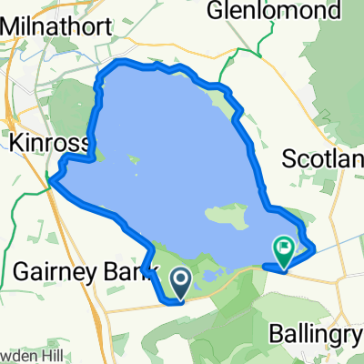
Ballingry mit dem Fahrrad
Entdecke eine Karte mit 45 Radrouten und Radwegen rund um Ballingry, erstellt von unserer Community.
Regionenporträt
Lerne Ballingry kennen
Finde die richtige Fahrradroute in Ballingry, wo wir 45 Fahrradrouten für dich zum Erkunden haben. Die meisten Leute fahren hier im Monat Mai Fahrrad.
1.596 km
Aufgezeichnete Strecken
45
Fahrradrouten
5.758
Einwohner
Community
Die aktivsten Nutzer in Ballingry
Von unserer Community
Die besten Fahrradrouten in und um Ballingry
Banks of Loch Leven
Fahrradtour in Ballingry, Schottland, Vereinigtes Königreich
- 19,8 km
- Distanz
- 35 m
- Aufstieg
- 35 m
- Abstieg
Easy Lochore trails loop (low)
Fahrradtour in Ballingry, Schottland, Vereinigtes Königreich
Lochore Meadows trails.
- 8 km
- Distanz
- 39 m
- Aufstieg
- 39 m
- Abstieg
Around Lomond Hills and Strathearn
Fahrradtour in Ballingry, Schottland, Vereinigtes Königreich
over 3,500 feet climbing in less that 50 miles - was pretty knackered after that! Stunning scenery almost all the way, loads of wildlife to spot. Great coffee shop at Falkland (Kind Kyttocks - a bit gentile inside but carry out and sit on park benches) and shops at Glenfarg, Dunning, Milnathort. A couple of very steep sections (33 and 37 miles) and a couple of long (three miles?) climbs.
- 76,9 km
- Distanz
- 833 m
- Aufstieg
- 833 m
- Abstieg
Lochore Sprint Tri - Bike leg?
Fahrradtour in Ballingry, Schottland, Vereinigtes Königreich
The initial 700m is on the park access road prior to joining the B920 at a mini roundabout. Turn left and continue out on the B920 through Crosshill and Lochore – take care at the pedestrian crossing. These lights may not be disabled, so obey the indication.
Follow the road on through Ballingry to the junction with the B9097 and turn left. After 5.5 kms turn left on to the main road (B996). Do not take this junction too fast as you are joining a main road!
Continue south on this road until approaching the built up area in Cowdenbeath. Turn sharp left at the roundabout, again taking care, as this is an acute turn.
Follow the main road through the built up areas of Lumphinans and Lochgelly – take particular care at the pedestrian crossings. The road has a ninety-degree left turn in Lochgelly. Two pedestrian crossings precede this natural turn and another follows it. These lights may not be disabled, so you must obey the indication.
On leaving Lochgelly take care at the next small roundabout, continuing straight on. Take care also then on the fast right sweeping descent passing under the railway bridge. After the bridge, take care at the pedestrian crossing outside the school. Continue to the next mini roundabout and turn left into Lochore Meadows.
- 20,5 km
- Distanz
- 193 m
- Aufstieg
- 194 m
- Abstieg
Mehr Routen entdecken
- Slow ride in
- Distanz
- 6 km
- Aufstieg
- 0 m
- Abstieg
- 0 m
- Standort
- Ballingry, Schottland, Vereinigtes Königreich
- B9097, Kinross to B9097, Kinross
- Distanz
- 20,2 km
- Aufstieg
- 209 m
- Abstieg
- 205 m
- Standort
- Ballingry, Schottland, Vereinigtes Königreich
- Restful route in
- Distanz
- 18,1 km
- Aufstieg
- 216 m
- Abstieg
- 209 m
- Standort
- Ballingry, Schottland, Vereinigtes Königreich
- meadies
- Distanz
- 7,1 km
- Aufstieg
- 355 m
- Abstieg
- 361 m
- Standort
- Ballingry, Schottland, Vereinigtes Königreich
- Lochore Trails Loop (High)
- Distanz
- 9,1 km
- Aufstieg
- 99 m
- Abstieg
- 98 m
- Standort
- Ballingry, Schottland, Vereinigtes Königreich
- Ochil Hills Sportiv
- Distanz
- 160,9 km
- Aufstieg
- 1.044 m
- Abstieg
- 1.044 m
- Standort
- Ballingry, Schottland, Vereinigtes Königreich
- Ochill Hills Sportif Short
- Distanz
- 76,3 km
- Aufstieg
- 678 m
- Abstieg
- 678 m
- Standort
- Ballingry, Schottland, Vereinigtes Königreich
- Loch Leven
- Distanz
- 12,6 km
- Aufstieg
- 48 m
- Abstieg
- 32 m
- Standort
- Ballingry, Schottland, Vereinigtes Königreich