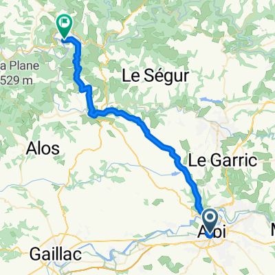
Radfahren in Albi
Entdecke eine Karte mit 190 Radrouten und Radwegen rund um Albi, erstellt von unserer Community.
Regionenporträt
Lerne Albi kennen
Finde die richtige Fahrradroute in Albi, wo wir 190 Fahrradrouten für dich zum Erkunden haben. Die meisten Leute fahren hier in den Monaten April und August Fahrrad.
15.069 km
Aufgezeichnete Strecken
190
Fahrradrouten
52.409
Einwohner
Community
Die aktivsten Nutzer in Albi
Von unserer Community
Die besten Fahrradrouten in und um Albi
2016 Ride Day 134 - Albi to Millau
Fahrradtour in Albi, Languedoc-Roussillon-Midi-Pyrénées, Frankreich
This was a super, but very tiring ride with the heat, the ride's length and a few climbs. Outstanding zero and low traffic roads the whole way except for the time in and close to Albi and Millau. After a late start about 11:30, we just beat the sunset.
Note that a few tunnels seriously ov
- 111,8 km
- Distanz
- 921 m
- Aufstieg
- 662 m
- Abstieg
2019-10 Albi to Millau
Fahrradtour in Albi, Languedoc-Roussillon-Midi-Pyrénées, Frankreich
In 2019, we did self-supported touring for a little less than 2 months from mid-September through early November.
Day 10 - Albi to Millau
This was an absolutely wonderful ride. D172 to Ambialet is a great way to get out of Albi. The rest of the roads, with the one except
- 105,9 km
- Distanz
- 1.104 m
- Aufstieg
- 632 m
- Abstieg
2016 Ride Day 167 - Albi to Villefranche-de-Rouergue
Fahrradtour in Albi, Languedoc-Roussillon-Midi-Pyrénées, Frankreich
Mostly great ride. D90, D905, and D905A were excellent low and zero traffic roads. D988 and D911 both had more traffic, but not bad.
- 73,2 km
- Distanz
- 1.001 m
- Aufstieg
- 895 m
- Abstieg
Albi - Circle to the Southeast
Fahrradtour in Albi, Languedoc-Roussillon-Midi-Pyrénées, Frankreich
Great ride on mostly scenic roads.
D81 up to Fréjairolles has bike land and good shoulder. After Fréjairolles, traffic fades and the road becomes a really nice scenic road.
From Teillet to Villefranche-d’Albigeoisto, the roads were excellenht low-traffic s
- 52,3 km
- Distanz
- 632 m
- Aufstieg
- 634 m
- Abstieg
Mehr Routen entdecken
- Albi - Circle to the Southwest and West
- Distanz
- 47,3 km
- Aufstieg
- 409 m
- Abstieg
- 406 m
- Standort
- Albi, Languedoc-Roussillon-Midi-Pyrénées, Frankreich
- Albi to Montauban
- Distanz
- 71,4 km
- Aufstieg
- 627 m
- Abstieg
- 676 m
- Standort
- Albi, Languedoc-Roussillon-Midi-Pyrénées, Frankreich
- 2012 French Tour -- Ride Day 59 -- 25 October 2012 -- Albi -- Circle
- Distanz
- 54,3 km
- Aufstieg
- 622 m
- Abstieg
- 622 m
- Standort
- Albi, Languedoc-Roussillon-Midi-Pyrénées, Frankreich
- **17-X. Albi - Saint Flour (197,5 Km)
- Distanz
- 197,3 km
- Aufstieg
- 3.336 m
- Abstieg
- 2.707 m
- Standort
- Albi, Languedoc-Roussillon-Midi-Pyrénées, Frankreich
- 4. Albi - Brousse-le-Chateau
- Distanz
- 70,3 km
- Aufstieg
- 904 m
- Abstieg
- 829 m
- Standort
- Albi, Languedoc-Roussillon-Midi-Pyrénées, Frankreich
- Albi to Bor et Bar
- Distanz
- 41,8 km
- Aufstieg
- 544 m
- Abstieg
- 528 m
- Standort
- Albi, Languedoc-Roussillon-Midi-Pyrénées, Frankreich
- Albi - Cordes (route de campagne)
- Distanz
- 56,5 km
- Aufstieg
- 647 m
- Abstieg
- 635 m
- Standort
- Albi, Languedoc-Roussillon-Midi-Pyrénées, Frankreich
- Saint-Juéry - côte de Saint-Sernin
- Distanz
- 98,6 km
- Aufstieg
- 3.184 m
- Abstieg
- 3.179 m
- Standort
- Albi, Languedoc-Roussillon-Midi-Pyrénées, Frankreich