
Mars Hill mit dem Fahrrad
Entdecke eine Karte mit 4 Radrouten und Radwegen rund um Mars Hill, erstellt von unserer Community.
Pioniere gesucht
Inspiriere andere Radfahrer mit deiner Route in Mars Hill
Bikemap ist eine globale Fahrrad-Community mit Millionen von Routen, die von Radfahrern wie dir erstellt wurden. Es gibt bisher nur wenige Routen in Mars Hill, also zeichne deine Lieblingsstrecken jetzt auf der Karte ein, um anderen zu helfen, die besten Radrouten zu finden.
Von unserer Community
Die besten Fahrradrouten in und um Mars Hill

North Main Street 114, Mars Hill to North Main Street 114, Mars Hill
Fahrradtour in Mars Hill, North Carolina, Vereinigte Staaten
- 34 km
- Distanz
- 462 m
- Aufstieg
- 462 m
- Abstieg

Hot Doggett Metric Century (2009)
Fahrradtour in Mars Hill, North Carolina, Vereinigte Staaten
- 103 km
- Distanz
- 2.651 m
- Aufstieg
- 2.482 m
- Abstieg
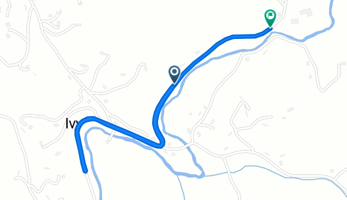
Beech Glen Road to Blue Herron Road
Fahrradtour in Mars Hill, North Carolina, Vereinigte Staaten
- 0,6 km
- Distanz
- 42 m
- Aufstieg
- 0 m
- Abstieg
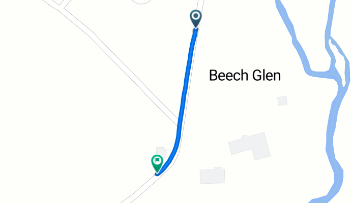
Beech Glen Road to Beech Glen Road
Fahrradtour in Mars Hill, North Carolina, Vereinigte Staaten
- 2,5 km
- Distanz
- 52 m
- Aufstieg
- 12 m
- Abstieg