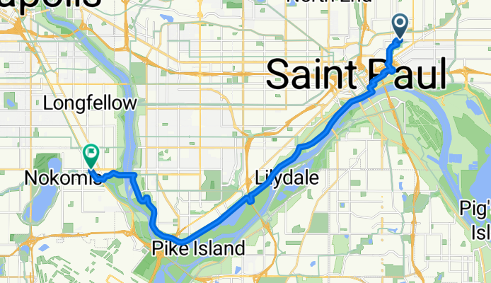
Wie Radfahren in Saint Paul aussehen könnte.

Saint Paul mit dem Fahrrad

Entdecke eine Karte mit 489 Radrouten und Radwegen rund um Saint Paul, erstellt von unserer Community.

Regionenporträt

Lerne Saint Paul kennen

Finde die richtige Fahrradroute in Saint Paul, wo wir 489 Fahrradrouten für dich zum Erkunden haben. Die meisten Leute fahren hier in den Monaten Juni und August Fahrrad.

20.543 km

Aufgezeichnete Strecken

489

Fahrradrouten

285.068

Einwohner

Community

Die aktivsten Nutzer in Saint Paul

Von unserer Community

Die besten Fahrradrouten in und um Saint Paul

River Ramble 20
RennradBefestigt
5

River Ramble 20

Fahrradtour in Saint Paul, Minnesota, Vereinigte Staaten

~20 miles along the Mississippi.   The outbound leg uses trails along Shepard and Warner roads, to Upper Afton road.  We would turn south through Battle Creek Park and make our way over fairly quiet roads along Hwy 61/10 down to the  Mississippi River crossing at I-494.  We’d return Northbound over MRT trails next to the river, up through Kaposia Landing, and finally taking the Concord-Cesar Chavez-Wabasha route through downtown, to the Transportation building.
29,6 km
Distanz
196 m
Aufstieg
197 m
Abstieg
B2B00368 55102 > 55417 via Shepard Rd, Godfrey, Minnehaha,  River Pkwy
CitybikeBefestigt
4

B2B00368 55102 > 55417 via Shepard Rd, Godfrey, Minnehaha, River Pkwy

Fahrradtour in Saint Paul, Minnesota, Vereinigte Staaten

Take Kellog past 7th St, and veer right onto Eagle Pkwy. Follow Eagle Pkwy down the hill to Shepard Rd (at the bottom of the hill). On the river side of Shepard Rd is a bike path. Take the Shepard Rd bike path all the way to Ford Pkwy. (Note: when you have to cross under 35E, you must follow the trail as it dips out of the way south for a little bit, but it will curve back north, don't worry!) At Ford Pkwy, take a left and cross the bridge.  When you get over the bridge, traffic is iffy for about the equivelant of 1 block.  You can walk your bike on the sidewalk for this patch if you dont feel comfortable in the street. Take a left onto 46th Ave (the first turn you can take once you're over the bridge). Take 46th Ave down the hill to the stopsign (note: there are bumpy cobblestones for a patch) Take a rigth onto Godfrey Rd and follow that in the bike path until just before you reach the roundabout, and take a left to head south east on Minnehaha Avenue in the bike path. Continue on Minnehaha Avenue until your reach 54th St E (note: along the way Minnehaha turns into River pkwy) Take a right on 54th St. to cross Hiawatha. Continue on 54th about 2 blocks and take a left onto Minnehaha Avenue. Continue on Minnehaha to your desination.
17,8 km
Distanz
96 m
Aufstieg
119 m
Abstieg
B2B00192 55102>55404viaShepherdRd/MissBlvd/WRiverPkwy/MidtwnGrnway
CitybikeBefestigt
2

B2B00192 55102>55404viaShepherdRd/MissBlvd/WRiverPkwy/MidtwnGrnway

Fahrradtour in Saint Paul, Minnesota, Vereinigte Staaten

This route is decidedly longer but is far more interesting and faster. Very few stops compared to a cross town route. Take Shepherd Road West along the Mississippi River. You can either ride on the bike path or on the road. Follow Shepherd Rd. past 35E until it becomes East Mississippi River Blvd. Continue on East Mississippi past the Ford Plant. Go under the Ford Pkwy. bridge and make an immediate right hairpin turn up to Ford Pkwy. and cross over the Mississippi on the Ford Bridge. Immediately at the end of the bridge is a path to the right that will take you down to West River Pkwy. Follow West River Pkwy. either on the road or bike path. Pass under Lake Street and continue on. At E.27th Street there is a path up to the Midtown Greenway Bike Trail. Take the bike trail west. At Hiawatha Avenue you can either continue straight ahead and cross with the stop light traffic or proceed on the bike path over the new Martin Sabo bridge. (Very cool at night with blue lights). Continue on the Greenway until you  reach Chicago Avenue. Exit up the steps to the street and go north on Chicago to 26th Street and your destination.
21,8 km
Distanz
131 m
Aufstieg
86 m
Abstieg
B2B00418 55117>55123 via Cedar, Wabasha, Lexington, Pilot Knob Rd
CitybikeBefestigt
2

B2B00418 55117>55123 via Cedar, Wabasha, Lexington, Pilot Knob Rd

Fahrradtour in Saint Paul, Minnesota, Vereinigte Staaten

Can take Wabasha to 10th St when going back north to Como.   There are bike paths alongside Pilot Knob Rd.   It is possible to take the Big Rivers Regional Trail farther south and get onto Pilot Knob from the trail system.
20,8 km
Distanz
161 m
Aufstieg
156 m
Abstieg

Mehr Routen entdecken