

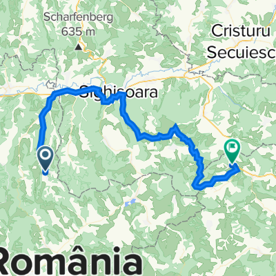
Colinele Transilvaniei: Circuit Mălâncrav - Hula Crișului - Dealul Sneal - Mălâncrav
Eine Fahrradroute, die in Mălâncrav, Sibiu, Rumänien beginnt.
Übersicht
Über diese Route
4
Verlassen Sie das Dorf in Richtung Osten zum Ciocârliei-Hügel. Der Weg beginnt sanft zu steigen zwischen Feldern und wird dann steiler auf einem Hügel durch den Wald. Gehen Sie rechts auf dem Gipfel (rotes Kreuzzeichen), lassen Sie den (blauen Streifen-)Weg links, der Sie nach Criș hinunterführt, und setzen Sie geradeaus weiter auf dem Hügel nach Süden fort, bis Sie die alte Kreisstraße und das rote Streifenzeichen erreichen. Folgenden Sie dem Weg nach rechts auf dem roten Streifenzeichen an der Wasserscheide, zunächst durch den Wald und dann über die Wiesen (schöne Panorama des Dorfes Mălâncrav). Lassen Sie den nach Stejărișu hinunterführenden Weg links und bald werden Sie rechts auf den Weg nach Mălâncrav stoßen. Nehmen Sie diesen Weg (rotes Kreuz), gehen Sie an einer Tierfarm vorbei und betreten Sie Mălâncrav von Süden her.
Haben Sie diese Strecke befahren? Wenn Sie Zugangprobleme festgestellt haben (fehlende, beschädigte oder unzureichend klare Markierungen, unpassierbare Abschnitte usw.) oder Vorschläge zur Verbesserung haben, schreiben Sie uns bitte an transylvanianhighlands@gmail.com. Vergessen Sie nicht, einen GPS-Punkt und ein paar Fotos zu machen - das hilft uns, schneller zu intervenieren, um die Situation zu beheben.
- -:--
- Dauer
- 18,2 km
- Distanz
- 447 m
- Aufstieg
- 445 m
- Abstieg
- ---
- Ø-Tempo
- 650 m
- Max. Höhe
Colinele Transilvaniei
Erstellt vor 4 Jahren
Routenqualität
Wegtypen und Untergründe entlang der Route
Wegtypen
Pfad
14 km
77 %
Forst- / Feldweg
2 km
11 %
Untergründe
Befestigt
1,3 km
(7 %)
Unbefestigt
2,4 km
(13 %)
Schotter
1,6 km
9 %
Asphalt
1,3 km
7 %
Weiter mit Bikemap
Diese Radroute verwenden, bearbeiten oder herunterladen
Du möchtest Colinele Transilvaniei: Circuit Mălâncrav - Hula Crișului - Dealul Sneal - Mălâncrav fahren oder sie für deine eigene Reise anpassen? Folgendes kannst du mit dieser Bikemap-Route machen:
Gratis Funktionen
- Speichere diese Route als Favorit oder in einer Sammlung
- Kopiere & plane deine eigene Version dieser Route
- Synchronisiere deine Route mit Garmin oder Wahoo
Premium-Funktionen
Kostenlose Testversion für 3 Tage oder einmalige Zahlung. Mehr über Bikemap Premium.
- Navigiere diese Route auf iOS & Android
- Exportiere eine GPX / KML-Datei dieser Route
- Erstelle deinen individuellen Ausdruck (Jetzt kostenlos ausprobieren)
- Lade diese Route für die Offline-Navigation herunter
Entdecke weitere Premium-Funktionen.
Bikemap Premium aktivierenVon unserer Community
Mălâncrav: Andere beliebte Routen, die hier beginnen
- Criș - Stejăreni - Breite - Angofa - Crucea Vulcanului - Sighișoara - Breite - Stejăreni - Criș0
- 48,3 km
- 956 m
- 969 m
- Mălâncrav, Sibiu, Rumänien
- Criș - Stejăreni - Breite - Angofa - Crucea Vulcanului - Sighișoara - Breite - Stejăreni - Criș1
- 48,3 km
- 956 m
- 969 m
- Mălâncrav, Sibiu, Rumänien


In der App öffnen