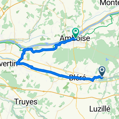
- 37 km
- 366 m
- 376 m
- Civray-de-Touraine, Centre-Val de Loire, Frankreich
Stage 3. Blois to Loches - 2 Chenonceaux to Loches
Eine Fahrradroute, die in Civray-de-Touraine, Centre-Val de Loire, Frankreich beginnt.
Übersicht
Über diese Route
Wunderschöne Landstraßen. Überqueren Sie die Cher und fahren Sie direkt nach Süden auf der D80. Fahren Sie an der xx in die D31 ein; überqueren Sie den Fluss/Stream und biegen Sie rechts auf die D94 ab. Biegen Sie links auf die D25 ab, wo sich die D94 mit der D94 vereinigt. Verlassen Sie die D94, biegen Sie links auf die D25 bei L'lle Thime ab. Fahren Sie den Fluss hinunter zu den Vororten von Loches. Links am Kreisverkehr auf die D764; links am nächsten Kreisverkehr auf der D764 in Richtung Loches. 18 Meilen nach dem Mittagessen. Das sollte eine fantastische Fahrt werden; die Straßen sehen unglaublich aus.
- -:--
- Dauer
- 29,7 km
- Distanz
- 175 m
- Aufstieg
- 163 m
- Abstieg
- ---
- Ø-Tempo
- ---
- Max. Höhe
Erstellt vor 14 Jahren
Weiter mit Bikemap
Diese Radroute verwenden, bearbeiten oder herunterladen
Du möchtest Stage 3. Blois to Loches - 2 Chenonceaux to Loches fahren oder sie für deine eigene Reise anpassen? Folgendes kannst du mit dieser Bikemap-Route machen:
Gratis Funktionen
- Speichere diese Route als Favorit oder in einer Sammlung
- Kopiere & plane deine eigene Version dieser Route
- Synchronisiere deine Route mit Garmin oder Wahoo
Premium-Funktionen
Kostenlose Testversion für 3 Tage oder einmalige Zahlung. Mehr über Bikemap Premium.
- Navigiere diese Route auf iOS & Android
- Exportiere eine GPX / KML-Datei dieser Route
- Erstelle deinen individuellen Ausdruck (Jetzt kostenlos ausprobieren)
- Lade diese Route für die Offline-Navigation herunter
Entdecke weitere Premium-Funktionen.
Bikemap Premium aktivierenVon unserer Community
Civray-de-Touraine: Andere beliebte Routen, die hier beginnen
- Rue du Château, Chenonceaux a Rue Édouard Vaillant, Tours
- Chenonceaux - Veretz - Mountlouis - Amboise
- 42,8 km
- 223 m
- 227 m
- Civray-de-Touraine, Centre-Val de Loire, Frankreich
- ambois
- 23,8 km
- 111 m
- 96 m
- Civray-de-Touraine, Centre-Val de Loire, Frankreich
- 8 Rue des Vignes, Francueil to 4 Rue de Poulas, Couffy
- 94,3 km
- 892 m
- 902 m
- Civray-de-Touraine, Centre-Val de Loire, Frankreich
- supermarkt en montpoupon
- 15,7 km
- 122 m
- 86 m
- Civray-de-Touraine, Centre-Val de Loire, Frankreich
- Stage 3. Blois to Loches - 2 Chenonceaux to Loches
- 29,7 km
- 175 m
- 163 m
- Civray-de-Touraine, Centre-Val de Loire, Frankreich
- 5 Rue des Vignes, Francueil to 2 Rue du Château, Valençay
- 52 km
- 247 m
- 203 m
- Civray-de-Touraine, Centre-Val de Loire, Frankreich
- Rue Bretonneau 6, Chenonceaux to le prieure de boulogne
- 75 km
- 347 m
- 320 m
- Civray-de-Touraine, Centre-Val de Loire, Frankreich
In der App öffnen


