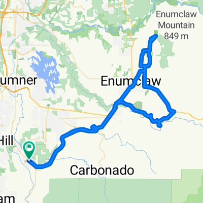
Foothills Trail, Orting to 80th Street East 13810, Puyallup

Eine Fahrradroute, die in Orting, Washington, United States of America beginnt.

Übersicht

Über diese Route

1
1 h 6 min
Dauer
13,6 km
Distanz
3 m
Aufstieg
47 m
Abstieg
12,3 km/h
Ø-Tempo
66 m
Ø-Tempo
Nutnicha Nigon
Nutnicha Nigon

Erstellt vor 1 Jahr

Fotos von der Route

Foto 1 der Bikemap-Route "Foothills Trail, Orting to 80th Street East 13810, Puyallup"Foto 2 der Bikemap-Route "Foothills Trail, Orting to 80th Street East 13810, Puyallup"Foto 3 der Bikemap-Route "Foothills Trail, Orting to 80th Street East 13810, Puyallup"Foto 4 der Bikemap-Route "Foothills Trail, Orting to 80th Street East 13810, Puyallup"Foto 5 der Bikemap-Route "Foothills Trail, Orting to 80th Street East 13810, Puyallup"Foto 6 der Bikemap-Route "Foothills Trail, Orting to 80th Street East 13810, Puyallup"Foto 7 der Bikemap-Route "Foothills Trail, Orting to 80th Street East 13810, Puyallup"Foto 8 der Bikemap-Route "Foothills Trail, Orting to 80th Street East 13810, Puyallup"

Routenqualität

Wegtypen und Untergründe entlang der Route

Weiter mit Bikemap

Diese Radroute verwenden, bearbeiten oder herunterladen

Du möchtest Foothills Trail, Orting to 80th Street East 13810, Puyallup fahren oder sie für deine eigene Reise anpassen? Folgendes kannst du mit dieser Bikemap-Route machen:

Gratis Funktionen

Premium-Funktionen

Kostenlose Testversion für 3 Tage oder einmalige Zahlung. Mehr über Bikemap Premium.

  • Navigiere diese Route auf iOS & Android
  • Exportiere eine GPX / KML-Datei dieser Route
  • Erstelle deinen individuellen Ausdruck (Jetzt kostenlos ausprobieren)
  • Lade diese Route für die Offline-Navigation herunter

Entdecke weitere Premium-Funktionen.

Bikemap Premium aktivieren

Von unserer Community

Orting: Andere beliebte Routen, die hier beginnen

In der App öffnen