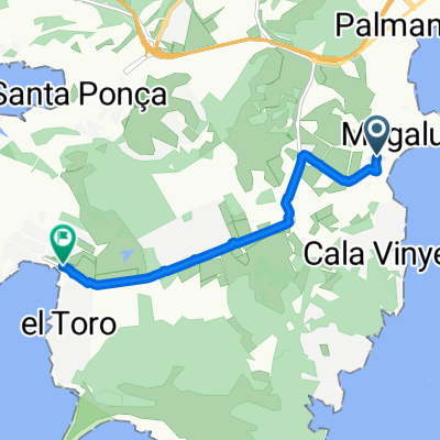
Calvia / Coll des Tords / Golf / Genova / Küstenstraße
- 43,3 km
- 433 m
- 432 m
- Magaluf, Balearische Inseln, Spanien
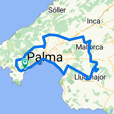
Mallorca - Palma Nova
Eine Fahrradroute, die in Magaluf, Balearische Inseln, Spanien beginnt.
Übersicht
Diese Route umfasst die beiden härtesten Anstiege auf Mallorca: Puig Mayor. 14 km, die wie ein endloser Anstieg erscheinen. Nicht sehr steil – aber wie der Mont Ventoux in Frankreich ist er fordernd wegen des ständigen Anstiegs.
Verschone dir deine Energie und genieße den ersten Teil nach Sollér. Hole frisches Wasser, bevor du in Puerto Sollér den Anstieg angehst.
Das Essen in der Altstadt von Sollér ist großartig. Auf dem Platz (Placa de España) findest du geeignete Restaurants.
Nach einer wunderschönen Fahrt über den Gipfel – die Autos werden durch einen Tunnel geleitet – fährst du zurück nach Palma.
Hinweis: Verrückte Typen fahren weiter vom Gipfel des Puig Mayor nach Sa Calobra.
Wenn Puig Mayor wie der Mont Ventoux ist, dann ist Sa Calobra wie Alpe d'Huez. Also voller Respekt, wenn du beides an einem Tag fährst.
Erstellt vor 14 Jahren
Teil von
3 Etappen
Highlights der Route
Udsigtspunkt og turens absolutte højdepunkt.
Benzintanke for proviant/vand
Weiter mit Bikemap
Du möchtest Palma Nova - King Stage of your tour fahren oder sie für deine eigene Reise anpassen? Folgendes kannst du mit dieser Bikemap-Route machen:
Kostenlose Testversion für 3 Tage oder einmalige Zahlung. Mehr über Bikemap Premium.
Entdecke weitere Premium-Funktionen.
Bikemap Premium aktivierenVon unserer Community
In der App öffnen