0
- 157,8 km
- 1.193 m
- 1.194 m
- Saint-Apollinaire, Bourgogne-Franche-Comté, Frankreich
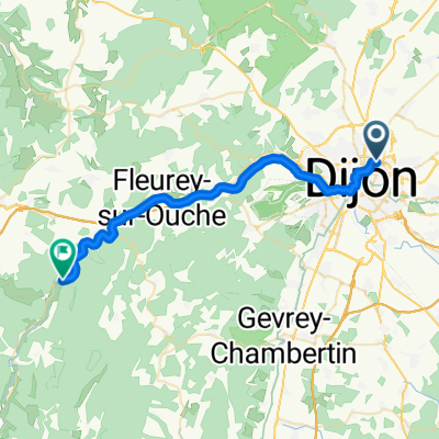
Eine Fahrradroute, die in Saint-Apollinaire, Bourgogne-Franche-Comté, Frankreich beginnt.
Übersicht
Einmal hatten wir einen relativ frühen Start, da wir um 8:45 Uhr auf der Straße waren. Beim Herausnehmen der Fahrräder begann es gerade, leicht zu regnen. Unbeirrt luden wir die Fahrräder und machten uns auf den Weg. Zum Glück war das der einzige Regen, den wir den ganzen Tag sahen. Allerdings hatten wir die Mühe eines manchmal kalten Gegenwinds, der durch die gesamten letzten zwei Drittel dieser langen Fahrt stark blieb. Was für viele Kilometer entlang der D10 in Richtung Venarey-les-Laumes am Oze Fluss eine schnelle Abfahrt hätte sein sollen, fühlte sich wie ein langer Anstieg an.
Die gesamte Länge der D7 war besonders schön zu fahren auf fast verkehrsfreien Straßen. Außerdem überquerten wir im Laufe des Tages vom Département Côte d’Or in der Bourgogne-Region ins Département Yonne in der Bourgogne-Region.
Hintergrund:
Meine Frau und ich machen seit 1993 Selbstversorger-Touren in Westeuropa (hauptsächlich in Frankreich). Diese Reihe von Fahrten umfasst unsere 4,5-monatige Route durch Teile von Frankreich, Deutschland, Österreich, der Schweiz und dann zurück nach Frankreich im Jahr 2009. Unser Anfangs- und Endpunkt ist in der Nähe von Chadurie (südlich von Angoulême), wo unsere Freunde einen Bauernhof mit Gîtes und Chambres d'Hôtes haben.
Wir fuhren unsere 1993 gekauften Dawes-Reise-Fahrräder, stark beladen mit 700Cx32-Reifen. Alle unsere Fahrten fanden auf asphaltierten Straßen statt, größtenteils mit sehr wenig Verkehr. Die einzigen unbefestigten Abschnitte waren einige Radwege in Deutschland und Österreich. Leider war das nicht so toll, da Helen mehrmals auf den unbefestigten Wegen fiel. Glücklicherweise jedoch keine ernsthaften Verletzungen.
Bei Fragen können Sie mir gerne eine E-Mail an jeffkadet@netdiving.com senden.
Jeff
Erstellt vor 13 Jahren
Routenqualität
Straße
22,7 km
19 %
Ruhige Straße
3,6 km
3 %
Befestigt
54,9 km
(46 %)
Unbefestigt
1,2 km
(1 %)
Asphalt
54,9 km
46 %
Schotter
1,2 km
1 %
Undefiniert
63,2 km
53 %
Weiter mit Bikemap
Du möchtest 2009 Euro Tour -- Ride Day 15 — 9 July 2009 — 21850 St-Apollinaire (Dijon) to 89200 Magny (Avallon) fahren oder sie für deine eigene Reise anpassen? Folgendes kannst du mit dieser Bikemap-Route machen:
Kostenlose Testversion für 3 Tage oder einmalige Zahlung. Mehr über Bikemap Premium.
Entdecke weitere Premium-Funktionen.
Bikemap Premium aktivierenVon unserer Community
In der App öffnen