

Route to Grand-Rue 19, Mertert
- 9,3 km
- 35 m
- 88 m
- Trierweiler, Rheinland-Pfalz, Deutschland
Eine Fahrradroute, die in Trierweiler, Rheinland-Pfalz, Deutschland beginnt.
Übersicht
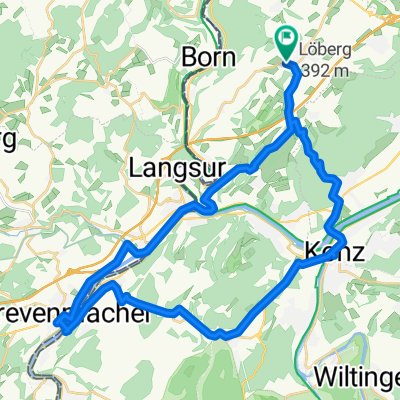
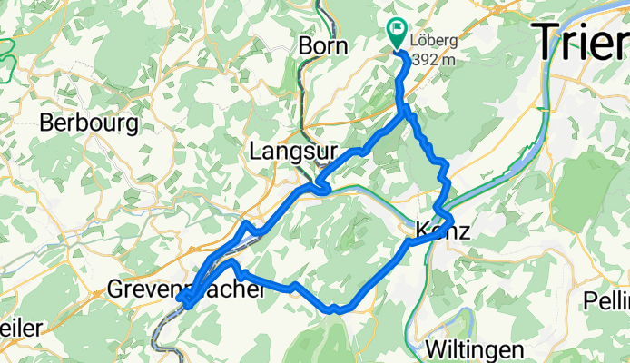
Embark on a scenic cycling adventure that spans across Germany and Luxembourg, beginning in Koppbach 16 and leading you to a delightful finish along the way. This 39.1 km route offers a mix of asphalt paths and forest trails, with a gentle ascent of 664 meters and a corresponding descent of 662 meters.
As you pedal through the picturesque landscapes of Rhénanie-Palatinat, Germany, you'll pass charming villages like Konz, Temmels, and Grevenmacher, each offering a glimpse into the region's rich history and culture. The route features a diverse array of surfaces, with a significant portion (81.6%) being smooth asphalt, providing a comfortable ride for all levels.
Enjoy the variety of way types along the path, including forest trails, frequently used paths, and serene country roads, making this route a perfect blend of adventure and tranquility. With a focus on both national and local bike networks, this journey caters to both seasoned cyclists and those seeking a leisurely ride.
Whether you're exploring the natural beauty of the region or simply enjoying a scenic ride, this cycling adventure promises an unforgettable experience. So gear up, embrace the open road, and set off on this captivating journey through Germany and Luxembourg.
KI-generiert
Erstellt vor 4 Monaten
Routenqualität
Forst- / Feldweg
10,2 km
26 %
Straße
6,6 km
17 %
Befestigt
34 km
(87 %)
Unbefestigt
2,3 km
(6 %)
Asphalt
31,6 km
81 %
Befestigt (undefiniert)
2,3 km
6 %
Weiter mit Bikemap
Du möchtest Trierweiler - Konz - Tawern - Grevenmacher - Trierweiler fahren oder sie für deine eigene Reise anpassen? Folgendes kannst du mit dieser Bikemap-Route machen:
Kostenlose Testversion für 3 Tage oder einmalige Zahlung. Mehr über Bikemap Premium.
Entdecke weitere Premium-Funktionen.
Bikemap Premium aktivierenVon unserer Community
In der App öffnen