


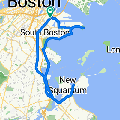
Bicycle ride from SouthEnd to Needham and Back.
Eine Fahrradroute, die in South Boston, Massachusetts, Vereinigte Staaten beginnt.
Übersicht
Über diese Route
3
Viel Spaß beim Fahren, eine Mischung aus Stadt, Verkehr und malerischen Straßen über eine Strecke von 17 Meilen (27 km)
-Startpunkt: Wunderschönes SouthEnd
-JamaicaPlain (Perkins Street): Einbahnstraßen, Verkehr, Leute und viele Leute, hübsche Geschäfte.
-Jamaica Pond: Über eine wunderschöne Strecke des Teichs gestoßen, nichts kann dem Auge mehr gefallen :)
- Hügeliges Terrain, sehr steile Straßen, großartiges Training von der Goddard Avenue, Newton St bis hin zur Dedham St.
-Route 9: eine gerade Straße, um zurück nach Boston zu kommen. (hat ein paar Steigungen, aber nicht so steil wie die auf der Goddard Ave.).
- -:--
- Dauer
- 26,9 km
- Distanz
- 165 m
- Aufstieg
- 168 m
- Abstieg
- ---
- Ø-Tempo
- ---
- Max. Höhe
Ravi Ramakrishnan
Erstellt vor 13 Jahren
Weiter mit Bikemap
Diese Radroute verwenden, bearbeiten oder herunterladen
Du möchtest Bicycle ride from SouthEnd to Needham and Back. fahren oder sie für deine eigene Reise anpassen? Folgendes kannst du mit dieser Bikemap-Route machen:
Gratis Funktionen
- Speichere diese Route als Favorit oder in einer Sammlung
- Kopiere & plane deine eigene Version dieser Route
- Synchronisiere deine Route mit Garmin oder Wahoo
Premium-Funktionen
Kostenlose Testversion für 3 Tage oder einmalige Zahlung. Mehr über Bikemap Premium.
- Navigiere diese Route auf iOS & Android
- Exportiere eine GPX / KML-Datei dieser Route
- Erstelle deinen individuellen Ausdruck (Jetzt kostenlos ausprobieren)
- Lade diese Route für die Offline-Navigation herunter
Entdecke weitere Premium-Funktionen.
Bikemap Premium aktivierenVon unserer Community
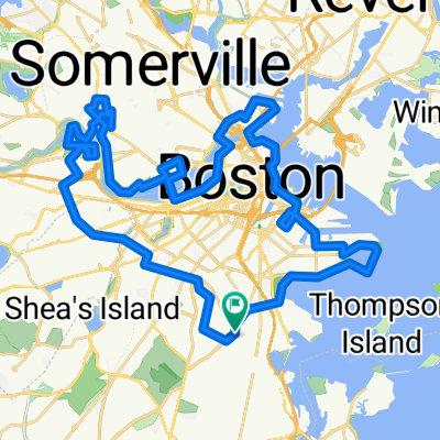
South Boston: Andere beliebte Routen, die hier beginnen


 William T Morrissey Blvd, Boston to 730 William T Morrissey Blvd, Boston0
- 0,8 km
- 3 m
- 3 m
- South Boston, Massachusetts, Vereinigte Staaten


In der App öffnen