

Camino 2015 6b Clairvaux nach Les Riceys
Eine Fahrradroute, die in Ville-sous-la-Ferté, Grand Est, Frankreich beginnt.
Übersicht
Über diese Route
0
<table border="0" cellpadding="0" cellspacing="0" style="width:618px;" width="619"> <colgroup> <col /> <col /> <col /> <col /> <col span="4" /> <col /> </colgroup> <tbody> <tr height="22"> <td height="22" style="height:22px;width:34px;"> 3,0</td> <td style="width:34px;"> 3,0</td> <td colspan="3" style="width:162px;"> (D12) Anstieg 120 hm</td> <td style="width:64px;"> </td> <td style="width:64px;"> </td> <td style="width:64px;"> </td> <td style="width:194px;"> </td> </tr> <tr height="22"> <td height="22" style="height:22px;width:34px;"> 8,9</td> <td style="width:34px;"> 5,9</td> <td colspan="7"> (D12) bis Champignol-lez-Mondeville Zentrum --> D70 (links)</td> </tr> <tr height="22"> <td height="22" style="height:22px;width:34px;"> 9,2</td> <td style="width:34px;"> 0,3</td> <td colspan="7"> am Ortsausgang: abknickende Vorfahrt nach rechts (D70)</td> </tr> <tr height="22"> <td height="22" style="height:22px;width:34px;"> 15,7</td> <td style="width:34px;"> 6,5</td> <td colspan="4"> Saint--Usage (links halten D70)</td> <td> </td> <td> </td> <td> </td> </tr> <tr height="22"> <td height="22" style="height:22px;width:34px;"> 17,7</td> <td style="width:34px;"> 2,0</td> <td colspan="3"> Fontette (D70)</td> <td> </td> <td> </td> <td> </td> <td> </td> </tr> <tr height="22"> <td height="22" style="height:22px;width:34px;"> 22,0</td> <td style="width:34px;"> 4,3</td> <td colspan="6"> Abbiege-Option vor Essoye (guter Schotterweg)</td> <td> </td> </tr> <tr height="22"> <td height="22" style="height:22px;width:34px;"> 24,5</td> <td style="width:34px;"> 2,5</td> <td colspan="4"> Essoyes (D67--> Loches)</td> <td> </td> <td> </td> <td> </td> </tr> <tr height="22"> <td height="22" style="height:22px;width:34px;"> 27,5</td> <td style="width:34px;"> 3,0</td> <td colspan="4"> Loches-sur-Ource (D145-->D67)</td> <td> </td> <td> </td> <td> </td> </tr> <tr height="22"> <td height="22" style="height:22px;width:34px;"> 30,0</td> <td style="width:34px;"> 2,5</td> <td colspan="2"> Londreville</td> <td> </td> <td> </td> <td> </td> <td> </td> <td> </td> </tr> <tr height="22"> <td height="22" style="height:22px;width:34px;"> 35,1</td> <td style="width:34px;"> 5,1</td> <td colspan="4"> Celles-sur-Ource (Brücke)</td> <td> </td> <td> </td> <td> </td> </tr> <tr height="22"> <td height="22" style="height:22px;width:34px;"> 35,7</td> <td style="width:34px;"> 0,6</td> <td colspan="7"> Abzweig nach Süden (gegenüber der Post: Rue de l'Église)</td> </tr> <tr height="22"> <td height="22" style="height:22px;width:34px;"> 36,9</td> <td style="width:34px;"> 1,2</td> <td colspan="7"> geradeaus in die Rue de Puits de Tour/Rue de Craies-->D671</td> </tr> <tr height="22"> <td height="22" style="height:22px;width:34px;"> 37,2</td> <td style="width:34px;"> 0,3</td> <td colspan="6"> --> hinter der Bahn D452 nach links Ri Polisy</td> <td> </td> </tr> <tr height="22"> <td height="22" style="height:22px;width:34px;"> 42,0</td> <td style="width:34px;"> 4,8</td> <td colspan="3"> Balnot-sur-Laignes</td> <td> </td> <td> </td> <td> </td> <td> </td> </tr> <tr height="21"> <td height="21" style="height:21px;width:34px;"> 45,1</td> <td style="width:34px;"> 3,1</td> <td colspan="3"> Ricey-Bas</td> <td> </td> <td> </td> <td> </td> <td> </td> </tr> </tbody> </table>
Hotel Le Marius 2 Place De L'église<br /> 10340 Les Riceys Telefon +33325293165- -:--
- Dauer
- 45,2 km
- Distanz
- 305 m
- Aufstieg
- 314 m
- Abstieg
- ---
- Ø-Tempo
- ---
- Max. Höhe
Enrique Peregrino
Erstellt vor 11 Jahren
Routenqualität
Wegtypen und Untergründe entlang der Route
Wegtypen
Straße
9,9 km
22 %
Forst- / Feldweg
4,5 km
10 %
Untergründe
Befestigt
5 km
(11 %)
Unbefestigt
1,8 km
(4 %)
Asphalt
4,5 km
10 %
Schotter
1,8 km
4 %
Weiter mit Bikemap
Diese Radroute verwenden, bearbeiten oder herunterladen
Du möchtest Camino 2015 6b Clairvaux nach Les Riceys fahren oder sie für deine eigene Reise anpassen? Folgendes kannst du mit dieser Bikemap-Route machen:
Gratis Funktionen
- Speichere diese Route als Favorit oder in einer Sammlung
- Kopiere & plane deine eigene Version dieser Route
- Synchronisiere deine Route mit Garmin oder Wahoo
Premium-Funktionen
Kostenlose Testversion für 3 Tage oder einmalige Zahlung. Mehr über Bikemap Premium.
- Navigiere diese Route auf iOS & Android
- Exportiere eine GPX / KML-Datei dieser Route
- Erstelle deinen individuellen Ausdruck (Jetzt kostenlos ausprobieren)
- Lade diese Route für die Offline-Navigation herunter
Entdecke weitere Premium-Funktionen.
Bikemap Premium aktivierenVon unserer Community
Ville-sous-la-Ferté: Andere beliebte Routen, die hier beginnen
- De Rue du Seilley 5, Ville-sous-la-Ferté à Rue de la Maison Commune 1, Charrey-sur-Seine0
- 46,2 km
- 616 m
- 629 m
- Ville-sous-la-Ferté, Grand Est, Frankreich
- De Route de Dijon 14, Ville-sous-la-Ferté à Rue du Moulin 3, Charrey-sur-Seine0
- 31,6 km
- 160 m
- 169 m
- Ville-sous-la-Ferté, Grand Est, Frankreich
- Camino 2015 6b Clairvaux nach Les Riceys0
- 45,2 km
- 305 m
- 314 m
- Ville-sous-la-Ferté, Grand Est, Frankreich
- De la Ferté à Rue Pierre Marasi 1, Laferté-sur-Aube0
- 66,1 km
- 662 m
- 655 m
- Ville-sous-la-Ferté, Grand Est, Frankreich
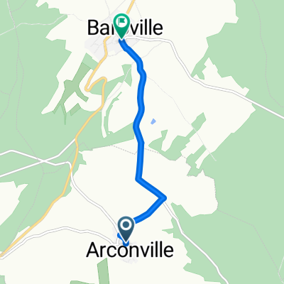
- De Rue de l'Abreuvoir à Baroville - Place Mairie0
- 4,3 km
- 78 m
- 141 m
- Ville-sous-la-Ferté, Grand Est, Frankreich


In der App öffnen