North to Utanobori and back
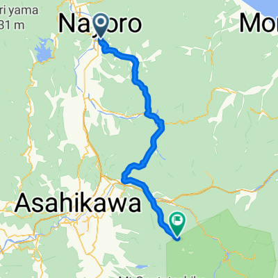
Eine Fahrradroute, die in Nayoro, Hokkaido, Japan beginnt.
Übersicht
Über diese Route
Skirting the National Highway as much as possible, the route heads north to Onnenai from where it follows the highway to the turn-off to Utanobori. Looping around the east flank of Hakodake, the roads are fairly untraveled until one returns to Bifuka, passing through Niuppu. The route then returns to Nayoro over Shinonome Pass.
- -:--
- Dauer
- 156,4 km
- Distanz
- 861 m
- Aufstieg
- 861 m
- Abstieg
- ---
- Ø-Tempo
- ---
- Ø-Tempo
Weiter mit Bikemap
Diese Radroute verwenden, bearbeiten oder herunterladen
Du möchtest North to Utanobori and back fahren oder sie für deine eigene Reise anpassen? Folgendes kannst du mit dieser Bikemap-Route machen:
Gratis Funktionen
- Speichere diese Route als Favorit oder in einer Sammlung
- Kopiere & plane deine eigene Version dieser Route
- Teile sie in Etappen ein, um eine mehrtägige Tour zu erstellen
- Synchronisiere deine Route mit Garmin oder Wahoo
Premium-Funktionen
Kostenlose Testversion für 3 Tage oder einmalige Zahlung. Mehr über Bikemap Premium.
- Navigiere diese Route auf iOS & Android
- Exportiere eine GPX / KML-Datei dieser Route
- Erstelle deinen individuellen Ausdruck (Jetzt kostenlos ausprobieren)
- Lade diese Route für die Offline-Navigation herunter
Entdecke weitere Premium-Funktionen.
Bikemap Premium aktivierenVon unserer Community
Nayoro: Andere beliebte Routen, die hier beginnen
- Nayoro Century 2015
- Distanz
- 146,3 km
- Aufstieg
- 1.352 m
- Abstieg
- 1.352 m
- Standort
- Nayoro, Hokkaido, Japan
- North to Utanobori and back
- Distanz
- 156,4 km
- Aufstieg
- 861 m
- Abstieg
- 861 m
- Standort
- Nayoro, Hokkaido, Japan
- Round Hakodake & Piyashiri
- Distanz
- 185,2 km
- Aufstieg
- 1.009 m
- Abstieg
- 1.007 m
- Standort
- Nayoro, Hokkaido, Japan
- SEP-01-10-NAYORO-ASAHIKAWA
- Distanz
- 82,8 km
- Aufstieg
- 260 m
- Abstieg
- 248 m
- Standort
- Nayoro, Hokkaido, Japan
- 名寄周回コース3(和寒)
- Distanz
- 93,3 km
- Aufstieg
- 134 m
- Abstieg
- 134 m
- Standort
- Nayoro, Hokkaido, Japan
- final stretch
- Distanz
- 198,3 km
- Aufstieg
- 1.227 m
- Abstieg
- 1.321 m
- Standort
- Nayoro, Hokkaido, Japan
- 名寄センチュリー70km・Nayoro Century 70km Course
- Distanz
- 70,3 km
- Aufstieg
- 765 m
- Abstieg
- 765 m
- Standort
- Nayoro, Hokkaido, Japan
- 名寄周回コース1(風連)
- Distanz
- 23 km
- Aufstieg
- 79 m
- Abstieg
- 80 m
- Standort
- Nayoro, Hokkaido, Japan
In der App öffnen