

B2B00098 55337>55424 via Ferry Brg, McCauley
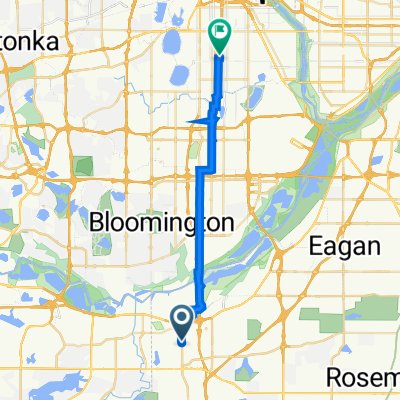
Eine Fahrradroute, die in Burnsville, Minnesota, Vereinigte Staaten beginnt.
Übersicht
Über diese Route
0
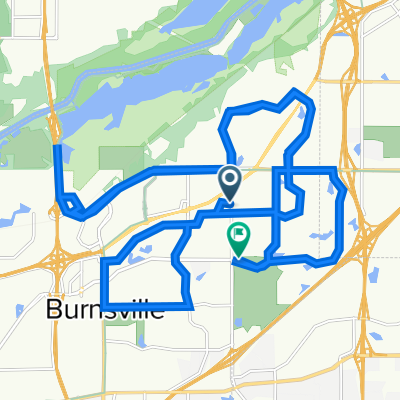
Dies ist eine schwierige Route. Ich habe die Route so direkt wie möglich gestaltet, aber der Nachteil ist viel Verkehr.
Punkte, auf die man achten sollte, sind:
- Die Ein- und Ausfahrten an Cliff und 35W
- Müllwagen auf Cliff westlich von 35W
- Die Zufahrtsstraßen zur Hwy 13 und der kurze Abschnitt der Hwy 13, den man fahren muss, um über die erhöhten Eisenbahnschienen zu kommen.
Wenn Ihr Plan ist, zum Transitcenter an Nic und 13 zu fahren und von dort mit dem Fahrrad weiterzufahren, ziehen Sie in Betracht, zum Parkplatz Minn Valley Refuge an 13 und Stagecoach zu fahren.
- -:--
- Dauer
- 33,8 km
- Distanz
- 156 m
- Aufstieg
- 132 m
- Abstieg
- ---
- Ø-Tempo
- ---
- Max. Höhe
Scot_Gore
Erstellt vor 18 Jahren
Highlights der Route
POIs entlang der Route
Interessanter Ort nach 3,1 km
Garbage and Gravel Trucks use this road.
Interessanter Ort nach 14,4 km
Long waits for trains is possible here.
Interessanter Ort nach 14,4 km
Interessanter Ort nach 18 km
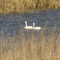
This area subject to spring flooding.
Weiter mit Bikemap
Diese Radroute verwenden, bearbeiten oder herunterladen
Du möchtest B2B00098 55337>55424 via Ferry Brg, McCauley fahren oder sie für deine eigene Reise anpassen? Folgendes kannst du mit dieser Bikemap-Route machen:
Gratis Funktionen
- Speichere diese Route als Favorit oder in einer Sammlung
- Kopiere & plane deine eigene Version dieser Route
- Synchronisiere deine Route mit Garmin oder Wahoo
Premium-Funktionen
Kostenlose Testversion für 3 Tage oder einmalige Zahlung. Mehr über Bikemap Premium.
- Navigiere diese Route auf iOS & Android
- Exportiere eine GPX / KML-Datei dieser Route
- Erstelle deinen individuellen Ausdruck (Jetzt kostenlos ausprobieren)
- Lade diese Route für die Offline-Navigation herunter
Entdecke weitere Premium-Funktionen.
Bikemap Premium aktivierenVon unserer Community
Burnsville: Andere beliebte Routen, die hier beginnen
- Black Dog Rd, Burnsville to Black Dog Rd, Burnsville0
- 12 km
- 3 m
- 4 m
- Burnsville, Minnesota, Vereinigte Staaten
- Black Dog Rd, Burnsville to Black Dog Rd, Burnsville0
- 11,7 km
- 9 m
- 6 m
- Burnsville, Minnesota, Vereinigte Staaten
- 1852 W Burnsville Pkwy, Burnsville to 3838 Clinton Ave, Minneapolis0
- 22,6 km
- 136 m
- 145 m
- Burnsville, Minnesota, Vereinigte Staaten
- Bluff Trail, Bloomington to Bluff Trail, Bloomington0
- 13,5 km
- 3 m
- 3 m
- Burnsville, Minnesota, Vereinigte Staaten
- Allen Dr, Burnsville to Upper 136th Street Ct W, Apple Valley1
- 9,6 km
- 66 m
- 72 m
- Burnsville, Minnesota, Vereinigte Staaten


In der App öffnen