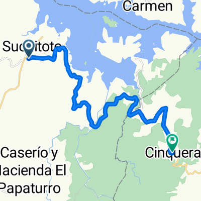
Suchi to San V
- 65,6 km
- 919 m
- 920 m
- Suchitoto, Departamento de Cuscatlán, El Salvador
Eine Fahrradroute, die in Suchitoto, Departamento de Cuscatlán, El Salvador beginnt.
Übersicht
Erstellt vor 9 Jahren
Routenqualität
Straße
25,6 km
19 %
Ruhige Straße
14,8 km
11 %
Befestigt
98,5 km
(73 %)
Unbefestigt
4 km
(3 %)
Asphalt
98,5 km
73 %
Schotter
2,7 km
2 %
Highlights der Route
San Vicente is dwarfed by pointy Volcán Chichontepec in the Jiboa Valley. Look out for the equally dramatic behemoth of Torre Kiosko, an otherworldly clock tower that juts from the farmland like some Disneyland ride gone haywire. Home to many musicians, San Vicente is also very gay-friendly – come July, the annual Miss Gay San Vicente draws quite the crowd (and contestants!). El Pilar, a beautiful colonial church built in the 1760s, was badly damaged by an earthquake; despite renovations, it remains closed. Read more: http://www.lonelyplanet.com/el-salvador/eastern-el-salvador/san-vicente/introduction#ixzz4Clgenhng
Valle de Ángeles is a beautiful former colonial mining town that makes for an easy day trip from Tegucigalpa. The town has been restored to its original 16th-century appearance in parts, especially around the attractive Parque Central, where there is a handsome old church. The annual fair takes place on October 4. Artisan souvenir shops line the streets, selling Honduran artesanías (handicrafts), including wood carvings, basketry, ceramics, leatherwork, paintings, dolls, wicker and wood furniture. Prices are usually less than in Tegucigalpa. Read more: http://www.lonelyplanet.com/honduras/valle-de-angeles/introduction#ixzz4Clr22Q3p
A visit to the former FMLN headquarters in the mountain town of Perquín is paramount to understanding El Salvador’s brutal civil war. It was in these hills that the opposition garnered its most loyal support, and despite vigorous bombing campaigns, the military was unable to dislodge the guerrilla forces. The town itself is small but the stunning pine forest surroundings can be seen at every turn, the mountain climate is agreeable and the war museum makes a trip here the highlight of El Salvador for many visitors. Read more: http://www.lonelyplanet.com/el-salvador/eastern-el-salvador/perquin/introduction#ixzz4CleYLC7h
Ringed by forested hills in a highland valley, sprawling Tegucigalpa enjoys a relatively fresh, mild climate and a spectacular setting. It's a bustling and dynamic place, but one that many travelers minimize their time in or skip over entirely. This is a shame, as while Tegus (as all locals call it) is no beauty – streets are choked with traffic and its resultant pollution, and crime stats are high – it's a fascinating place, with some good museums, restaurants and the air of a place on the up. Keep your ear to the ground and you'll discover a dynamic young urban scene led by emerging artists, musicians, DJs and designers. Read more: http://www.lonelyplanet.com/honduras/tegucigalpa/introduction#ixzz4CllG6JfP
Marcala is a highland town with a strong indigenous heritage. It lies at the southern end of Honduras’ 'Ruta Lenca' – a collection of Lenca villages and stronghold of Lencan culture. The town itself is tranquil but unremarkable, but it sits pretty in prime coffee country – there are several opportunities to see the world’s favorite bean being harvested and prepared. Several hikes in the surrounding area take in picturesque waterfalls and caves. Read more: http://www.lonelyplanet.com/honduras/western-honduras/marcala/introduction#ixzz4ClnX6PGO
The small traditional coastal communities around Laguna de Ibans are likely to be your first overnight stop if you enter the Moskitia via the overland route. Pick your base from a cluster of small settlements – Cocobila, Raista and Belén. All have good budget accommodations and are a short walk apart. The quiet Miskito village of Raista is possibly the nicest of the three, with wooden houses on stilts. There are beach walks (though trash spoils the scene), and wildlife-spotting hikes can be arranged to look for nesting sea turtles and crocs in the lagoon (no swimming here, folks!). If you get the chance, take in Plaplaya, a lovely, traditional Garifuna village a short boat ride from Raista, where giant leatherback sea turtles nest and are released by volunteers between April and July. Read more: http://www.lonelyplanet.com/honduras/laguna-de-ibans/introduction#ixzz4Clrcwnm4
Up in the highlands, slow-paced La Esperanza is known for its markets. Indigenous influence is strong here – you will see many women wearing the distinctive, colorful Lenca headdress. For these reasons – and not its muddy streets – it's a more interesting stopover than Marcala. As the highest town in Honduras (1770m), it can get decidedly chilly here, too
Comayagua was the first capital of Honduras and an important religious and political center for over three centuries, until power shifted to Tegucigalpa in 1880. The town’s rich past is evident in its fine old churches, an impressive cathedral and its colonial plazas. A very Catholic city, it’s the place in Honduras to witness Easter celebrations. The rest of the year, it's a pleasant stopover between Tegucigalpa and northern Honduras, though there's little to detain you for longer. On the outskirts of the town is a huge air base used by the US military. Known as La Palmerola (or Soto Cano), it formed a base for US forces in the 1980s when the Contra war was raging in Nicaragua. Today about a thousand soldiers are stationed here, and you'll often see off-duty soldiers relaxing in town. Read more: http://www.lonelyplanet.com/honduras/western-honduras/comayagua/introduction#ixzz4ClmYi0D5
Isolated, plucky Trujillo is the end of the line for the Honduran mainland: beyond it lies the virtually roadless jungle of the Moskitia, so there's a frontier-town vibe about the place. The town's setting is magnificent, with soaring mountains in the distance and the wide arc of the Bahía de Trujillo, a brilliant blue expanse of water that has seen the sails of Columbus and many a famous buccaneer, spread out before it. Trujillo boasts some interesting history, excellent nearby beaches and a slow-moving Caribbean air you won't find anywhere else on Honduras' northern coastline. For years the town has been talked up as Honduras' next big tourism thing, and the completion of a ship terminal means that occasionally the town is swamped by cruise travelers, but thankfully not often: the rest of the year things carry on as they always have done in this delightful, semi-forgotten place. Read more: http://www.lonelyplanet.com/honduras/northern-honduras/trujillo/introduction#ixzz4Clm5EJ22
La Ceiba is known as Honduras’ good-time town: 'Tegucigalpa thinks, San Pedro Sula works and La Ceiba parties,' so the saying goes. Certainly this port city's buzzing nightlife makes it a mecca for fiesta-hungry Hondurans, though nearly all the action is over the estuary in Barrio La Isla, the city’s zona viva (nightlife district). Elsewhere, expect searing heat and punishing humidity (and take care after dark). There's otherwise very little of interest in Ceiba itself: local beaches are polluted and unsafe and the downtown has a crumbling, neglected air (though it's still streets ahead of Tela on the charm front). Despite this, most travelers will find themselves here at some point as Ceiba is the transportation hub for the Bay Islands, as well as a great base for exploring the Pico Bonito National Park, the idyllic Cayos Cochinos and the world-class white water on the Río Cangrejal. Read more: http://www.lonelyplanet.com/honduras/northern-honduras/la-ceiba/introduction#ixzz4Clv4KFld
Some 21km east of La Ceiba, Sambo Creek is a thriving Garifuna fishing village. It's a slightly scruffy but fascinating place where you'll see women in striking attire and traditional headdresses. A punta (traditional Garifuna dance) party is never far away. The beach is a lovely stretch of sand, which most of the year is pretty clean, though trash washes up after storms
This tiny, traditional mountain town is well worth a stop if you've an interest in Lenca life and culture. Excursions include a trek to La Cascada de los Duendes, which goes through cloud forest and a series of waterfalls, ending with a coffee finca tour; and El Cañon Encantado, a tour of local beauty spots. Horseback riding, visits to traditional artisans, and coffee roasting and tasting tours can also be arranged
Largely undeveloped and ringed by dense tropical forest, Lago de Yojoa is exceptionally scenic. Thanks to the indefatigable efforts of a local microbrewery owner to promote the region, the lake is now the most popular spot for breaking the journey between the Bay Islands and Nicaragua. Lago de Yojoa's birdlife is world-class: the latest species count is up to 485 – over half the total in Honduras – including the elusive quetzal. You can also hike to remote waterfalls and the summit of Santa Bárbara, visit coffee plantations, go tubing and zip lining or row on the lake itself. (As it's very shallow, with many reeds close to shore, swimming here is not great.) Peña Blanca is the main transportation hub near the lake; it's a bustling but uninteresting commercial town. Los Naranjos, an otherwise unremarkable village some way down a poorly maintained road, is where most travelers base themselves at D&D Brewery. Read more: http://www.lonelyplanet.com/honduras/western-honduras/lago-de-yojoa/introduction#ixzz4Clp70XDA
Chalate' is the capital of the mountainous Chalatenango province in the country's north. There's a lovely daily rhythm here, as the narrow streets fill with farm trucks laden with fruit, sugarcane, indigo and coffee en route to the morning market on Calle San Martín, where you might just meet a cowboy. Colorful buses are stacked with friendly locals selling DVDs, toiletries and glittery sequined dresses; locals will strike up conversation in no time. It's a pleasant place to walk around as you catch glimpses of the spectacular La Peña mountains and the Cerro Verde further west, both likely destinations if you've made it this far. Another popular day trip is to Lago de Suchitlan to the east. The stains of history are hard to erase here. There’s a real contrast between the ambitious, city-bound youth and a generation of leather-skinned subsistence farmers recounting tales of FMLN might. The large military garrison on the plaza was built during wartime to rein in revolutionary activity in this FMLN stronghold. Share on Facebook Share on Twitter Share on Google+ Share on Stumbleupon S Read more: http://www.lonelyplanet.com/el-salvador/northern-el-salvador/chalatenango/introduction#ixzz4Clfgb5Wl
Belén Gualcho is a highly picturesque colonial town clinging to the side of a mountain at 1600m above sea level, on the other side of Parque Nacional Montaña de Celaque from Gracias. Attractions include an interesting iglesia and an excellent Lenca market on Sunday. There’s an entrance to Parque Nacional Celaque here, and a rural trail leading to San Manuel Colohete, but no services
Gracias is a small, tranquil cobblestone town that's one of the prettiest and most historic settlements in Honduras. For a brief time in the 16th century, it was the capital of all Spanish-conquered Central America and traces of its former grandeur remain in its centuries-old buildings, colonial churches and impressive fort. It's been in a state of slow but charming decline ever since, and today the pace of life here rarely moves beyond walking. Founded in 1526 by Spanish Captain Juan de Chávez, its original name was Gracias a Dios (Thanks to God). Eventually the town’s importance was eclipsed by Antigua (Guatemala) and Comayagua. The area around Gracias, including Parque Nacional Montaña de Celaque, is mountainous and beautiful, much of it forested, and the main reason to come to Gracias is to explore the undulating countryside around the town itself. The rolling green countryside around Gracias includes two very popular thermal springs, several traditional Lenca villages and some superb canyon scenery, where zip lining is available in the village of La Campa Read more: http://www.lonelyplanet.com/honduras/western-honduras/gracias/introduction#ixzz4Clmzj6Ct
Tacuba is a small, pretty mountain outpost known to travelers as the access point for the wilds of Parque Nacional El Imposible. At 680m and atop a one-way road, the lush, green setting mesmerizes first-time visitors, but its isolation is a double-edged sword. Tacuba is known in left-wing political circles as the site of the Americas’ first communist revolution in 1932; today, sustainable tourism appears a more likely long-term hope to lift the town's economic fortunes Read more: http://www.lonelyplanet.com/el-salvador/western-el-salvador/tacuba/introduction#ixzz4ClhsxO00
mmontecristo regne woud
The town of Copán Ruinas, often simply called Copán, is a beautiful place, paved with cobblestones and lined with white adobe buildings with red-tiled roofs. It's also one of the most charming and traveler-oriented places in Honduras, with a friendly local population, widely spoken English and some great hotels and restaurants. Many people come here just to see the famous nearby Maya ruins, but with plenty of other attractions in the town and nearby, there's reason enough to linger Read more: http://www.lonelyplanet.com/honduras/western-honduras/copan-ruinas/introduction#ixzz4CllcD4xS
La Palma Starring murals upon murals in the rainbow-colored, naïve art–style made famous by local boy Fernando Llort, La Palma is a tiny village which makes a big splash of paint. A two-hour drive north of San Salvador, the clean mountain air and access to exceptional hiking trails is reason enough to visit, but given every bus stop, spare wall and park bench screams at you in thick pastel daubs, the playful irreverence keeps you happily grounded. These bright, primitive images of mountain villages, campesinos (farmers) or Christ are synonymous with the modern Salvadoran art movement. Llort taught local residents how to create the same images and started a successful cooperative. Today 75% of the village makes a living by mass-producing these bright motifs. When it is time to move on, there are challenging peaks to test most. Serious hikers often prefer lodging in the neighboring village of San Ignacio as it’s closer to the main trails. Read more: http://www.lonelyplanet.com/el-salvador/northern-el-salvador/la-palma/introduction#ixzz4ClfM98TF
Santa Rosa de Copán is a workaday mountain town with cobbled streets and some lovely, restored colonial buildings. There's little to see in the town itself, but as a base in the region it's a decent choice. The annual festival day is August 30; the town is also renowned for its colorful Semana Santa celebrations
La Entrada to Nuevo Chamelecón
The region surrounding the town of Tela is a fascinatingly diverse place. Within a relatively small area you'll find some great beaches, several nature reserves, thriving Garifuna villages and one of the world's largest botanical gardens Tela is a run-down urban resort whose beaches are, sadly, full of trash and in many places simply unsafe even during daytime. Its town center is fairly unattractive and definitely not safe after dark, while its hotels and restaurants are mediocre and overpriced. Yet despite all that, many people pass through and even stay a night or two here to visit the fantastic Lancetilla Jardín Botánico, the largest botanical garden in the Americas. The two nearby nature reserves – Jeannette Kawas and Punta Izopo – are both wonderful excursions as well, and within easy striking distance of the town. Tela is crammed with Honduran vacationers during Semana Santa (Holy Week before Easter), but the rest of the year things are pretty tranquilo. Read more: http://www.lonelyplanet.com/honduras/northern-honduras/tela/introduction#ixzz4CltQGuUU
Located about 4km northeast of West End, Sandy Bay is a quiet little community popular with expats. Here the Carambola Botanical Gardens covers a protected hillside, with several nature trails filled with orchids, spice plants, an ‘iguana wall’ and lots of wandering agoutis (rodent-like animals). As the name suggests, there's a decent beach here. It's a chilled-out alternative to far busier West End
La Entrada to Nuevo Chamelecón
Omoa feels like the end of the road, and indeed this unremarkable town 18km west of Puerto Cortés sees few visitors. Despite this fact, it's an attractive little resort on a broad curving bay that makes for great sunsets, even if, due to coastal erosion, the brown-sugar beach is minimal. There's a historic fort and a clutch of seafood restaurants along the seafront
Utila is a charming island that has enjoyed a reputation for years as the place to learn to dive in Latin America. While it may no longer be an incredible bargain due to new taxes on diving, Utila remains diving-obsessed and is one of Honduras' most popular backpacker haunts. Utila is small (about 13km long and 5km wide) and focused almost entirely on Utila Town, the island's only settlement, which is set on a curving bay with two small beaches and dozens of hotels, restaurants, bars and dive shops. With only a few roads, much of the island is impenetrable wilderness accessible only by sea. Utila earns its keep mainly from its reef, with over a dozen dive schools and some excellent dive sites around the shoreline. Another huge draw: the juvenile whale sharks – gentle giants measuring up to 6m long – that are regularly spotted around the island. Read more: http://www.lonelyplanet.com/honduras/bay-islands/utila/introduction#ixzz4Clln0boJ
Weiter mit Bikemap
Du möchtest dfgfs fahren oder sie für deine eigene Reise anpassen? Folgendes kannst du mit dieser Bikemap-Route machen:
Kostenlose Testversion für 3 Tage oder einmalige Zahlung. Mehr über Bikemap Premium.
Entdecke weitere Premium-Funktionen.
Bikemap Premium aktivierenVon unserer Community
In der App öffnen