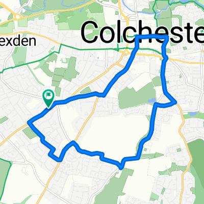
Colchester Station to Campsite
- 98,2 km
- 325 m
- 315 m
- Colchester, England, Vereinigtes Königreich
Eine Fahrradroute, die in Colchester, England, Vereinigtes Königreich beginnt.
Übersicht
TREFFPUNKT: B&Q KREISVERKEHR
Fahren Sie am B&Q-Kreisverkehr die Hawkins Road hinunter und folgen Sie dabei dem National Cycle Route 51. Am Ende der Hawkins Road sollten Sie links abbiegen.
Nach Beendigung des National Cycle Route 51 sollten Sie links auf den Cycle Route 1 abbiegen, nachdem Sie die Brücke im Castle Park überquert haben. Sie sollten jetzt auf Pavilion View sein.
Folgen Sie dem Cycle Route 1 zurück, überqueren Sie den River Colne und erreichen Sie Middle Mill.
Bleiben Sie auf Cycle Route 1 und sollten jetzt auf der High Street ankommen. Biegen Sie rechts in die High Street ab und folgen Sie weiterhin der Radroute.
Oben an der High Street angekommen, überqueren Sie North Hill und biegen auf Balkerine Passage ab, dabei weiterhin Cycle Route 1 folgend. Fahren Sie den Weg hinunter, bis Sie die Brücke erreichen, die über die A134 führt. Diese sollten Sie überqueren.
Einmal auf Popes Ln, biegen Sie links auf Crowhurst Road ab und fahren bis Sie Papillon Road sehen, in die Sie rechts abbiegen sollten.
Folgen Sie weiterhin Route 1, biegen Sie links in Rawston Road ab und folgen Sie, bis Sie Southway (A1224) erreichen. Es sollte einen Radweg an der Seite der Straße geben.
Sie sollten diesem für kurze Zeit folgen und in Norman Way abbiegen, nachdem Sie die St. Marys School auf der rechten Seite passiert haben. Sie sollten weiterhin auf Cycle Route 1 sein.
Folgen Sie Cycle Route 1 nach Lexden, fahren Sie durch Beech Hill, Church Road, Heath Road, die gerade Straße und Clairmont Road (durch ein Feld). Danach sollten Sie rechts auf Cycle Route 13 abbiegen.
Folgen Sie New Farm Road hinunter, überqueren Sie die London Road (an der Zebrastreifenüberquerung) und fahren Sie weiter auf King Coel Road, immer noch auf Cycle Route 13.
Biegen Sie links in Halstead Road ab und überqueren Sie die A12, bevor Sie rechts auf Chitts Hill abbiegen.
Chitts Hill sollte weiterbefahren werden und achten Sie auf die Nummern der Cycle Route 13 zur Navigation.
Nach einer langen Fahrt auf Chitts Hill, biegen Sie links in Argents Lane ab. Sie sollten den River Colne kurz vorher sehen.
Argents Lane geht in Heath Road über, folgen Sie dem wie gewohnt, biegen Sie rechts in Wood Lane und direkt danach links in Fiddlers Hill ab.
Am River Colne sollte die Straße in Mill Road übergehen. Dies ist alles weiterhin Cycle Route 13.
Mill Road wandelt sich dann in Church Road. Fahren Sie weiter hinunter bis nach Fordham. Dann fahren Sie danach weiter auf Moat Road.
Biegen Sie rechts in Chappel Road ab, nachdem Sie Fordham verlassen haben, was dann in Bridge Hill übergeht. Fahren Sie diese Straße hinunter. Sie sollte ziemlich lang sein.
Folgen Sie Route 13 und biegen Sie rechts ab, wenn die Straße endet. Sie sollten jetzt auf der Fordham Road sein, die später in Roberts Hill übergeht.
Folgen Sie weiterhin Route 13, biegen Sie am Ende von Roberts Hill links ab und folgen Sie, bis Sie Hall Road erreichen.
In Hall Road biegen Sie rechts ab und passieren die Thachers Arms. Sie sollten diese Straße weiter hinauf fahren, bis Sie den letzten Teil der B1508 (Colchester Road) erreichen, wo Sie links abbiegen. Sie sollten weiterhin auf Route 13 sein.
Fahren Sie weiter, bis Sie Bridge Street erreichen, wo Sie rechts abbiegen.
Biegen Sie links ab, wenn Sie Church Square/High Street am Ende von Bridge Street erreichen. Folgen Sie dieser Straße, bis Sie 'The Croft' auf Ihrer linken Seite sehen. Biegen Sie dort ab, und das Bures Scout Haus sollte sich auf dieser Straße befinden.
#ALLES GESCHAUT MIT RADWEGEN 51, 1 UND 13#
Routenqualität
Ruhige Straße
10,4 km
39 %
Straße
7,8 km
29 %
Befestigt
7 km
(26 %)
Unbefestigt
2,7 km
(10 %)
Asphalt
6,4 km
24 %
Natürlicher Untergrund
2,1 km
8 %
Weiter mit Bikemap
Du möchtest Bures Campsite fahren oder sie für deine eigene Reise anpassen? Folgendes kannst du mit dieser Bikemap-Route machen:
Kostenlose Testversion für 3 Tage oder einmalige Zahlung. Mehr über Bikemap Premium.
Entdecke weitere Premium-Funktionen.
Bikemap Premium aktivierenVon unserer Community
In der App öffnen