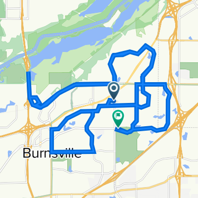
B2B00357 55337>55403 via High Line Trl, Pilot Knob Rd, Mendota Bridge, Hiawatha Trl
Eine Fahrradroute, die in Burnsville, Minnesota, United States of America beginnt.
Übersicht
Über diese Route
This route gives plenty of options since the distance is so long. The route mapped relies mostly on bike paths and trails. Pilot Knob has paths on both sides of the road but caution should be taken as the path crosses busy intersections and driveways.
The path continues through Ft Snelling and up onto the Hiawatha Trail, where you will ride next to the light rail practically to downtown.
If traffic is not a concern, it would be possible to take Sibley Hwy (13) to the Mendota bridge, but you would have to rely on a shoulder.
Another option is to take the light rail from the 494 bridge crossing. The crossing ends in a cul-de-sac where you can get on the road (E 80th/American Blvd) and follow the road to a stop light. If you take a left onto 34th Ave/Old Shakopee there will be a path to get to a light rail station.
- -:--
- Dauer
- 35,3 km
- Distanz
- 212 m
- Aufstieg
- 230 m
- Abstieg
- ---
- Ø-Tempo
- ---
- Ø-Tempo
Routenqualität
Wegtypen und Untergründe entlang der Route
Wegtypen
Undefiniert
35,3 km
(100 %)
Untergründe
Undefiniert
35,3 km
(100 %)
Highlights der Route
POIs entlang der Route
Interessanter Ort nach 16 km
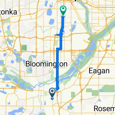
494 path to light rail station
Interessanter Ort nach 16,9 km
Continue on path to light rail station
Interessanter Ort nach 16,9 km
Light Rail station
Weiter mit Bikemap
Diese Radroute verwenden, bearbeiten oder herunterladen
Du möchtest B2B00357 55337>55403 via High Line Trl, Pilot Knob Rd, Mendota Bridge, Hiawatha Trl fahren oder sie für deine eigene Reise anpassen? Folgendes kannst du mit dieser Bikemap-Route machen:
Gratis Funktionen
- Speichere diese Route als Favorit oder in einer Sammlung
- Kopiere & plane deine eigene Version dieser Route
- Synchronisiere deine Route mit Garmin oder Wahoo
Premium-Funktionen
Kostenlose Testversion für 3 Tage oder einmalige Zahlung. Mehr über Bikemap Premium.
- Navigiere diese Route auf iOS & Android
- Exportiere eine GPX / KML-Datei dieser Route
- Erstelle deinen individuellen Ausdruck (Jetzt kostenlos ausprobieren)
- Lade diese Route für die Offline-Navigation herunter
Entdecke weitere Premium-Funktionen.
Bikemap Premium aktivierenVon unserer Community
Burnsville: Andere beliebte Routen, die hier beginnen
- B2B00574 55337>55378 via Judicial Rd, McColl Dr, Hwy 13
- Distanz
- 10 km
- Aufstieg
- 84 m
- Abstieg
- 116 m
- Standort
- Burnsville, Minnesota, USA
- B2B00769 55337>55102 via High Line Trl, Pilot Knob, Victoria Rd, Shepard Rd
- Distanz
- 25,2 km
- Aufstieg
- 100 m
- Abstieg
- 170 m
- Standort
- Burnsville, Minnesota, USA
- B2B00496 55337>55102 via Hwy 13, Bg Rvr Trl, Watter St
- Distanz
- 23,9 km
- Aufstieg
- 180 m
- Abstieg
- 239 m
- Standort
- Burnsville, Minnesota, USA
- B2B00477 55337>55144 via High Line Trl, Deerwood Dr, Wescott Rd, Delaware Rd, Charlton St
- Distanz
- 42,2 km
- Aufstieg
- 276 m
- Abstieg
- 256 m
- Standort
- Burnsville, Minnesota, USA
- Cannon Falls Lake Billsbey
- Distanz
- 48,6 km
- Aufstieg
- 102 m
- Abstieg
- 130 m
- Standort
- Burnsville, Minnesota, USA
- B2B00098 55337>55424 via Ferry Brg, McCauley
- Distanz
- 33,8 km
- Aufstieg
- 156 m
- Abstieg
- 132 m
- Standort
- Burnsville, Minnesota, USA
- B2B00753 55337>55102 via Rvrs Hills Dr, Bg Rvrs Trl
- Distanz
- 32,6 km
- Aufstieg
- 188 m
- Abstieg
- 205 m
- Standort
- Burnsville, Minnesota, USA
- Awesome training ride
- Distanz
- 32,9 km
- Aufstieg
- 177 m
- Abstieg
- 174 m
- Standort
- Burnsville, Minnesota, USA