- 13 km
- 42 m
- 59 m
- North Saint Paul, Minnesota, Vereinigte Staaten
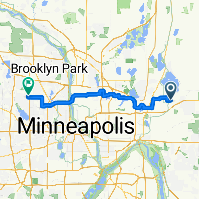
B2B00426 55119>55101 viaLarpenteur/E.Shore/Gateway/Cayuga/Jackson
Eine Fahrradroute, die in North Saint Paul, Minnesota, Vereinigte Staaten beginnt.
Übersicht
Über diese Route
Nehmen Sie die Larpenteurstraße nach Westen bis zum Lake Phalen. Biegen Sie rechts auf die E. Shore ab. Fahren Sie entweder auf der Straße oder auf dem Radweg um den See auf der E. Shore. Halten Sie sich am nördlichen Ende des Sees links und folgen Sie dem Radweg zur Kreuzung und biegen Sie rechts ab. Fahren Sie unter der Frost Ave. hindurch und machen Sie eine Haarnadelkurve zum Gateway Trail. Biegen Sie rechts auf das Gateway ab und folgen Sie dem Gateway vorbei an Forest Lawn und überqueren Sie Edgerton. Fahren Sie weiter auf dem Gateway bis zum Ende/Start des Trails an der Cayuga St. Fahren Sie geradeaus auf der L'Orient St. Es wird sich nach rechts kurven und zur Acker St. E werden. Folgen Sie der Acker bis zur Jackson St. und biegen Sie links ab. Folgen Sie der Jackson den Hügel hinunter über die University Av und über die I94 in die Innenstadt von St. Paul. Fahren Sie weiter zur E. 7th St. und biegen Sie rechts ab. Gehen Sie drei Blocks bis Cedar St. und zu Ihrem Ziel.
- -:--
- Dauer
- 13 km
- Distanz
- 88 m
- Aufstieg
- 153 m
- Abstieg
- ---
- Ø-Tempo
- ---
- Max. Höhe
Weiter mit Bikemap
Diese Radroute verwenden, bearbeiten oder herunterladen
Du möchtest B2B00426 55119>55101 viaLarpenteur/E.Shore/Gateway/Cayuga/Jackson fahren oder sie für deine eigene Reise anpassen? Folgendes kannst du mit dieser Bikemap-Route machen:
Gratis Funktionen
- Speichere diese Route als Favorit oder in einer Sammlung
- Kopiere & plane deine eigene Version dieser Route
- Synchronisiere deine Route mit Garmin oder Wahoo
Premium-Funktionen
Kostenlose Testversion für 3 Tage oder einmalige Zahlung. Mehr über Bikemap Premium.
- Navigiere diese Route auf iOS & Android
- Exportiere eine GPX / KML-Datei dieser Route
- Erstelle deinen individuellen Ausdruck (Jetzt kostenlos ausprobieren)
- Lade diese Route für die Offline-Navigation herunter
Entdecke weitere Premium-Funktionen.
Bikemap Premium aktivierenVon unserer Community
North Saint Paul: Andere beliebte Routen, die hier beginnen
- Back to St. Paul
- B2B00426 55119>55101 viaLarpenteur/E.Shore/Gateway/Cayuga/Jackson
- 13 km
- 88 m
- 153 m
- North Saint Paul, Minnesota, Vereinigte Staaten
- B2B00462 55115>55442 via Bruce Vento Trl, Co Rd E, 44th Av NE, 42nd Av N
- 47,1 km
- 152 m
- 192 m
- North Saint Paul, Minnesota, Vereinigte Staaten
- Twin Cities Lakes and Rivers 100K
- 118,9 km
- 312 m
- 298 m
- North Saint Paul, Minnesota, Vereinigte Staaten
- B2B00179 55109>55121 via Gateway, Jackson & Delaware
- 26 km
- 160 m
- 159 m
- North Saint Paul, Minnesota, Vereinigte Staaten
- B2B00953 55119>55003 viaIvy/Maryland/StillwaterBlvd/LkElmoAv/30thStN/Stagecoach/5thAV
- 25,9 km
- 112 m
- 180 m
- North Saint Paul, Minnesota, Vereinigte Staaten
- B2B00376 55109>55112 via Co Rd C, County Dr, N Owasso Blvd
- 17,4 km
- 52 m
- 74 m
- North Saint Paul, Minnesota, Vereinigte Staaten
- B2B00290 55109>55422 via Cty C, St Anthony Pkwy, Victory Mem Dr
- 30,8 km
- 126 m
- 136 m
- North Saint Paul, Minnesota, Vereinigte Staaten
In der App öffnen


