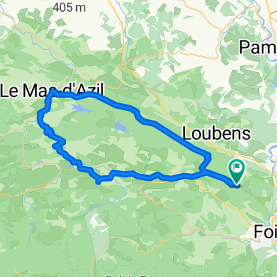
- 40,7 km
- 759 m
- 785 m
- Foix, Occitanie, Frankreich
2019-06 Foix - Circle to Col de Péguère
Eine Fahrradroute, die in Foix, Occitanie, Frankreich beginnt.
Übersicht
Über diese Route
Im Jahr 2019 haben wir fast 2 Monate lang von Mitte September bis Anfang November selbstgeführte Touren gemacht.
Tag 6 - Foix - Rundtour zum Col de Péguerre
Wir haben die meisten Teile dieser Tour schon viele Male gemacht. Die D17 von Foix zum Col de Péguerre auf 1375M (vorbei am Col des Marrous auf 990M und dem Col de Jouels auf 1247M). Dies ist eine wunderbare Strecke mit sehr wenig Verkehr, sobald man St-Pierre-de-Rivière passiert hat. Der Anstieg ist größtenteils relativ sanft, ohne steile Abschnitte über 8 %. Die Aussicht an der Spitze ist großartig, obwohl der Wald unterwegs den Blick stark einschränkt.
D15 war neu für uns. Es war eine herausragend gut ausgebaute fast verkehrsfreie Einbahnstraße (der Abschnitt von D17 etwa zehn oder zwölf Kilometer hinunter), der eine echte Herausforderung beim Überwinden darstellen würde. Bei dieser Fahrt sind wir hinuntergefahren, freuen uns aber darauf, eines Tages wieder hinaufzufahren.
Kurz nachdem wir D117 erreicht hatten, fuhren wir auf die Voie Verte, die ein einfaches Fahren ohne Autos war. Diese Voie Verte ist nicht asphaltiert, aber der größte Teil ist ziemlich gut befestigt. Unsere 700x35 Reifen haben damit keine Probleme. Während der größte Teil der Voie Verte in ziemlich gutem Zustand ist, degeneriert ein Teil näher bei Foix in etwas, das besser als ein Ziegenpfad ist, aber nicht viel besser. Rennräder mit schmalen Reifen sollten auf diesem Abschnitt vorsichtig sein ... oder ihn vermeiden, indem sie die D117 nehmen, die größtenteils parallel zu dem Pfad verläuft.
Dies war eine großartige Tour, die wir auf jeden Fall empfehlen.
- -:--
- Dauer
- 76,9 km
- Distanz
- 1.138 m
- Aufstieg
- 1.137 m
- Abstieg
- ---
- Ø-Tempo
- ---
- Max. Höhe
Erstellt vor 6 Jahren
Fotos von der Route
Routenqualität
Wegtypen und Untergründe entlang der Route
Wegtypen
Straße
43,1 km
(56 %)
Radweg
11,5 km
(15 %)
Untergründe
Befestigt
53,8 km
(70 %)
Unbefestigt
13,8 km
(18 %)
Asphalt
53,8 km
(70 %)
Loser Schotter
11,5 km
(15 %)
Weiter mit Bikemap
Diese Radroute verwenden, bearbeiten oder herunterladen
Du möchtest 2019-06 Foix - Circle to Col de Péguère fahren oder sie für deine eigene Reise anpassen? Folgendes kannst du mit dieser Bikemap-Route machen:
Gratis Funktionen
- Speichere diese Route als Favorit oder in einer Sammlung
- Kopiere & plane deine eigene Version dieser Route
- Synchronisiere deine Route mit Garmin oder Wahoo
Premium-Funktionen
Kostenlose Testversion für 3 Tage oder einmalige Zahlung. Mehr über Bikemap Premium.
- Navigiere diese Route auf iOS & Android
- Exportiere eine GPX / KML-Datei dieser Route
- Erstelle deinen individuellen Ausdruck (Jetzt kostenlos ausprobieren)
- Lade diese Route für die Offline-Navigation herunter
Entdecke weitere Premium-Funktionen.
Bikemap Premium aktivierenVon unserer Community
Foix: Andere beliebte Routen, die hier beginnen
- 40k around the Séronais
- Soulcem AR
- 98,4 km
- 1.429 m
- 1.435 m
- Foix, Occitanie, Frankreich
- 50k Flat To Mas d'Azil
- 51,9 km
- 570 m
- 578 m
- Foix, Occitanie, Frankreich
- **16-M. Foix - Gaillac (156 Km)
- 155,8 km
- 995 m
- 1.284 m
- Foix, Occitanie, Frankreich
- Le Tour De France: Stage 17
- 150,7 km
- 3.098 m
- 2.843 m
- Foix, Occitanie, Frankreich
- Esplad-de-Sèrou
- 53,5 km
- 1.176 m
- 1.159 m
- Foix, Occitanie, Frankreich
- Foix - Saint Martory
- 77,8 km
- 808 m
- 884 m
- Foix, Occitanie, Frankreich
- C2C 2-2 136km
- 135,6 km
- 2.195 m
- 2.176 m
- Foix, Occitanie, Frankreich
In der App öffnen


