Alsózsolca-Szerencs 2nd edition
Eine Fahrradroute, die in Alsózsolca, Komitat Borsod-Abaúj-Zemplén, Ungarn beginnt.
Übersicht
Über diese Route
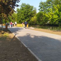
the route in the beginning around the entry of Onga isn't so comfortable and safe because of the quality of the pave and the overpopulated plains of gipsis(gipsy), and ruins where they live as nomads. This is typical in some strayed villages like Alsódobsza and megyaszó, but i think it'd be a great trip, by go past them fast, for every1, not only for a professional. But it's not so easy in any moments... as a matter of fact it's hard as much as you can imagine. Sometimes there are more winds what slows you down more than you expected... It can cause huge decreasing of avarage speed... but if you go back to Miskolc from about Alsódobsza to Gesztely you could cought back-wind there, you'd be reach easily about 45-50 kmper hours avarage speed. It's a nice trip for the lazy mornings with amazing landscapes between vilages. I recommend it for every1!!
- -:--
- Dauer
- 39 km
- Distanz
- 165 m
- Aufstieg
- 162 m
- Abstieg
- ---
- Ø-Tempo
- 226 m
- Max. Höhe
Routenqualität
Wegtypen und Untergründe entlang der Route
Wegtypen
Vielbefahrene Straße
23,7 km
(61 %)
Ruhige Straße
8,1 km
(21 %)
Untergründe
Befestigt
0,2 km
(<1 %)
Unbefestigt
0,4 km
(1 %)
Natürlicher Untergrund
0,4 km
(1 %)
Asphalt
0,2 km
(<1 %)
Undefiniert
38,4 km
(99 %)
Weiter mit Bikemap
Diese Radroute verwenden, bearbeiten oder herunterladen
Du möchtest Alsózsolca-Szerencs 2nd edition fahren oder sie für deine eigene Reise anpassen? Folgendes kannst du mit dieser Bikemap-Route machen:
Gratis Funktionen
- Speichere diese Route als Favorit oder in einer Sammlung
- Kopiere & plane deine eigene Version dieser Route
- Synchronisiere deine Route mit Garmin oder Wahoo
Premium-Funktionen
Kostenlose Testversion für 3 Tage oder einmalige Zahlung. Mehr über Bikemap Premium.
- Navigiere diese Route auf iOS & Android
- Exportiere eine GPX / KML-Datei dieser Route
- Erstelle deinen individuellen Ausdruck (Jetzt kostenlos ausprobieren)
- Lade diese Route für die Offline-Navigation herunter
Entdecke weitere Premium-Funktionen.
Bikemap Premium aktivierenVon unserer Community
Alsózsolca: Andere beliebte Routen, die hier beginnen
 456789öü
- Distanz
- 126 km
- Aufstieg
- 1.791 m
- Abstieg
- 892 m
- Standort
- Alsózsolca, Komitat Borsod-Abaúj-Zemplén, Ungarn
 Szacsvay Imre utca 2a, Miskolc - Szacsvay Imre utca 2a, Miskolc
- Distanz
- 19,4 km
- Aufstieg
- 45 m
- Abstieg
- 89 m
- Standort
- Alsózsolca, Komitat Borsod-Abaúj-Zemplén, Ungarn
 Lillafüred
- Distanz
- 23,4 km
- Aufstieg
- 212 m
- Abstieg
- 9 m
- Standort
- Alsózsolca, Komitat Borsod-Abaúj-Zemplén, Ungarn
 template
- Distanz
- 122,2 km
- Aufstieg
- 1.726 m
- Abstieg
- 846 m
- Standort
- Alsózsolca, Komitat Borsod-Abaúj-Zemplén, Ungarn
 Alsózsolca-Bükkszentkereszt-Alsózsolca
- Distanz
- 63,5 km
- Aufstieg
- 641 m
- Abstieg
- 640 m
- Standort
- Alsózsolca, Komitat Borsod-Abaúj-Zemplén, Ungarn
 Szacsvay Imre utca 2a, Miskolc - Szacsvay Imre utca 2a, Miskolc
- Distanz
- 27,3 km
- Aufstieg
- 20 m
- Abstieg
- 64 m
- Standort
- Alsózsolca, Komitat Borsod-Abaúj-Zemplén, Ungarn
 Szacsvay Imre utca 2a, Miskolc - Szacsvay Imre utca 2a, Miskolc
- Distanz
- 10,4 km
- Aufstieg
- 23 m
- Abstieg
- 20 m
- Standort
- Alsózsolca, Komitat Borsod-Abaúj-Zemplén, Ungarn
 Alsózsolca-Alsózsolca
- Distanz
- 32,7 km
- Aufstieg
- 22 m
- Abstieg
- 23 m
- Standort
- Alsózsolca, Komitat Borsod-Abaúj-Zemplén, Ungarn
In der App öffnen


