1
- 28,3 km
- 65 m
- 44 m
- Gainesville, Florida, Vereinigte Staaten
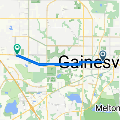
Eine Fahrradroute, die in Gainesville, Florida, Vereinigte Staaten beginnt.
Übersicht
Eine inoffizielle Fahrradtour durch Gainesville mit Fokus auf historische Stätten und Stadtviertel.
Erstellt vor 5 Jahren
Routenqualität
Ruhige Straße
3,3 km
60 %
Straße
0,8 km
15 %
Befestigt
2,3 km
(41 %)
Asphalt
1,7 km
30 %
Beton
0,3 km
6 %
Highlights der Route
Pleasant Hill MCB is a church that is associated with Civil rights in Alachua county and North central Florida. The church is associated with Reverend T. A Wright, a local leader of the NAACP during that era.

Historic Firestone Building: It was built in 1927 for the Firestone Tire and Rubber Company until it was abandoned in the 1950s. When the economy dipped, 40 years later, Pheobe Cade Miles (the Daughter of Dr. Cade) acquired the building initially for offices and event space. This proved costly. The building today houses local business Scout GPS/IoT.

Porters Ballpark: This site, known locally as the ballpark, was the center of recreational activities in Gainesville for more than 60 years. From 1883-1910 Gainesville's Oak Hall baseball team played here against teams from Florida and the Southeast. The Oak Halls played the first-night baseball game in Alachua County here in 1909. The Central City Giants, an African-American team, also played baseball here.

The Duckpond Neighborhood in Gainesville FL is Gainesville's first neighborhood. It began in the 1870s, and embraces 8 subdivisions (but only comprises a total of 292 acres in size). The neighborhood is extremely walkable, extending only 1 mile by one-half mile in size, and sitting adjacent to downtown Gainesville. Streets are a connected grid pattern, with sidewalks on both sides of all streets. Most streets are curbed and quite narrow. Residents are extremely sociable, proud, and fiercely protective of the neighborhood. 4 University of Florida presidents had houses in Duckpond.

Construction for what is now known as the Thomas Center began in 1906 and was completed in 1910. It was named “Sunkist Villa.” Major William Reuben Thomas, his wife Kathryn and their five children made the impressive estate their home for 15 years. With the addition of a three story wing, the family home was remodeled into a Mediterranean Revival-style hotel with Italian Renaissance decorative motifs. The Hotel Thomas was opened on January 10, 1928. It is now a cultural events center for the community and surrounding areas

Mount Pleasant Methodist Episcopal Church was founded on July 16, 1867, with the Reverend Isaac Davis serving as the first pastor. The Board of Trustees of the oldest black congregation in Gainesville.
Weiter mit Bikemap
Du möchtest Historic Gainesville Bike Trail fahren oder sie für deine eigene Reise anpassen? Folgendes kannst du mit dieser Bikemap-Route machen:
Kostenlose Testversion für 3 Tage oder einmalige Zahlung. Mehr über Bikemap Premium.
Entdecke weitere Premium-Funktionen.
Bikemap Premium aktivierenVon unserer Community
In der App öffnen