- 9,4 km
- 74 m
- 83 m
- Taringa, State of Queensland, Australien
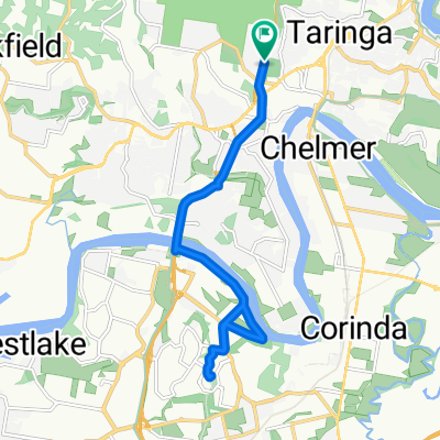
Brisbane River Loop
Eine Fahrradroute, die in Taringa, State of Queensland, Australien beginnt.
Übersicht
Über diese Route
The Brisbane River Loop is popular recreational cycle route that follows the Brisbane River from South Bank to Indooroopilly and back again.
This route is popular on weekends with cyclists of all stripes heading out to get some fresh air and exercise. The majority of the route is on residential back streets, although there are some more busy stretches further out of the city. There is a good mix of flat and hill cycling, and you can also choose the Mini Brisbane River Loop should the full loop prove too challenging.
The full loop is 35-40 km, whereas the mini loop is slightly under 20 km.
- -:--
- Dauer
- 38 km
- Distanz
- 162 m
- Aufstieg
- 165 m
- Abstieg
- ---
- Ø-Tempo
- ---
- Max. Höhe
Erstellt vor 5 Jahren
Routenqualität
Wegtypen und Untergründe entlang der Route
Wegtypen
Ruhige Straße
13,7 km
(36 %)
Radweg
12,5 km
(33 %)
Untergründe
Befestigt
38 km
(100 %)
Asphalt
29,2 km
(77 %)
Beton
7,6 km
(20 %)
Befestigt (undefiniert)
1,1 km
(3 %)
Weiter mit Bikemap
Diese Radroute verwenden, bearbeiten oder herunterladen
Du möchtest Brisbane River Loop fahren oder sie für deine eigene Reise anpassen? Folgendes kannst du mit dieser Bikemap-Route machen:
Gratis Funktionen
- Speichere diese Route als Favorit oder in einer Sammlung
- Kopiere & plane deine eigene Version dieser Route
- Synchronisiere deine Route mit Garmin oder Wahoo
Premium-Funktionen
Kostenlose Testversion für 3 Tage oder einmalige Zahlung. Mehr über Bikemap Premium.
- Navigiere diese Route auf iOS & Android
- Exportiere eine GPX / KML-Datei dieser Route
- Erstelle deinen individuellen Ausdruck (Jetzt kostenlos ausprobieren)
- Lade diese Route für die Offline-Navigation herunter
Entdecke weitere Premium-Funktionen.
Bikemap Premium aktivierenVon unserer Community
Taringa: Andere beliebte Routen, die hier beginnen
- Walter’s Steakhouse
- Queenscroft St, Chelmer to Queenscroft St, Chelmer
- 17,3 km
- 127 m
- 127 m
- Taringa, State of Queensland, Australien
- Miskin St, Toowong to Miskin St, Toowong
- 31,4 km
- 288 m
- 290 m
- Taringa, State of Queensland, Australien
- Rover Bike Night
- 17,4 km
- 197 m
- 199 m
- Taringa, State of Queensland, Australien
- Mount Cootha loop
- 9,8 km
- 292 m
- 277 m
- Taringa, State of Queensland, Australien
- Indooroopilly Rd, Indooroopilly to Indooroopilly Rd, Indooroopilly
- 31,7 km
- 275 m
- 274 m
- Taringa, State of Queensland, Australien
- Mt Cootha + riverloop
- 53,5 km
- 608 m
- 626 m
- Taringa, State of Queensland, Australien
- Mt Cootha finish with breakfast
- 5,9 km
- 268 m
- 272 m
- Taringa, State of Queensland, Australien
In der App öffnen


