Tour of Cotswolds Epic
- 114,7 km
- 723 m
- 723 m
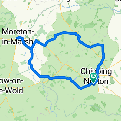
- Chipping Norton, England, Vereinigtes Königreich
Eine Fahrradroute, die in Chipping Norton, England, Vereinigtes Königreich beginnt.
Übersicht
Diese 90-Meilen-Route (148 km) ist eines der Segmente von "Der Weg des Rings", einer 555 km langen Route von Castlerigg Stone Circle in den Lakes nach Stonehenge, die durch oder in der Nähe von "neolithischen und historischen Stätten von Interesse" verläuft. Sie verfolgt eine wahrscheinliche Route, die von neolithischen Menschen genommen wurde, die mit ihren Schweinen und Rindern zu Stonehenge für die Wintersonnenwende reisten.
Dieses erste Segment ist 163 km (100 Meilen) lang und kann in 1-2 Tagen mit den folgenden Stätten erkundet werden:
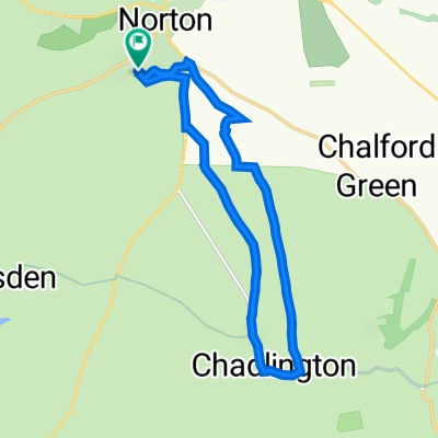
Rollright Stones (in der Nähe von Chipping Norton) Die Rollright Stones sind eine alte Stätte an der Grenze zwischen Oxfordshire und Warwickshire in England. Der Komplex besteht aus drei Hauptelementen: dem Steinkreis der Kings Men, dem King Stone und den Whispering Knights.
Blenheim Palace - durch die Grounds; Blenheim Palace ist ein UNESCO-Weltkulturerbe mit über 300 Jahren Geschichte und Heimat des 12. Herzogs von Marlborough und seiner Familie. Ein historisches Haus und Garten in Oxfordshire.
Uffington White Horse - Das Uffington White Horse ist eine prähistorische Hügelgestalt, 110 m (360 ft) lang, die aus tiefen Gräben besteht, die mit zerstoßenem weißem Kreide gefüllt sind. Die Figur befindet sich an den oberen Hängen des White Horse Hill, den die Route passiert.
Stanton Harcourt - Die Devil's Quoits, ein Henge-Denkmal wurde während der späten Neolithikum- und Beaker-Zeiten genutzt und bestand aus einem eingegrenzten Steinkreis mit einem Durchmesser von ca. 280 Fuß, bestehend aus 30 oder mehr Steinen; es wurde größtenteils im Mittelalter zerstört, um Platz für den Anbau zu schaffen, wobei einige der Steine gebrochen und möglicherweise in der Kirche von Stanton Harcourt wiederverwendet wurden.
Avebury - Avebury ist ein neolithisches Henge-Denkmal mit drei Steinkreisen rund um das Dorf Avebury. Eine der bekanntesten prähistorischen Stätten in Großbritannien enthält den größten megalithischen Steinkreis der Welt.
Durrington Walls - Durrington Walls ist der Standort einer großen neolithischen Siedlung und späteren Henge-Einhegungsanlage im Stonehenge-Weltkulturerbe, 2 Meilen (3,2 km) nordöstlich von Stonehenge.
Woodhenge - Woodhenge ist eine stimmungsvolle neolithische Stätte in der Nähe von Stonehenge. Wahrscheinlich um 2500 v. Chr. erbaut, wurde ursprünglich geglaubt, dass es sich um die Überreste eines Grabhügels handelte, der von einem Wall und einem Graben umgeben war, die fast vollständig durch Pflügen zerstört wurden.
Stonehenge - der Beginn oder das Ende der Route - Stonehenge ist ein prähistorisches Denkmal zwei Meilen (3 km) westlich von Amesbury. Es besteht aus einem Ring von stehenden Steinen, die jeweils etwa 4,0 m hoch, 2,1 m breit und rund 25 Tonnen wiegen. Die Steine sind innerhalb von Erdwällen im dichtesten Komplex neolithischer und bronzezeitlicher Denkmäler in England platziert, einschließlich mehrerer hundert Tumuli (Grabhügel). Archäologen glauben, dass es zwischen 3000 v. Chr. und 2000 v. Chr. erbaut wurde.
Die Route kann von N nach S oder umgekehrt befahren werden. Es gibt Unterkünfte entlang der Strecke und hervorragende Landkneipen.
Transport - Bahnhof in Salisbury (Direktverbindung nach London) und Pewsey. Es gibt Transportmöglichkeiten nach Stonehenge und von Stonehenge (aber nicht fahrradfreundlich), sodass dies bedeuten würde, die Fahrräder in Stonehenge abzuschließen und den Transport zum Bahnhof Salisbury zu nehmen, um das Auto abzuholen usw. Wenn die Route über 1,5-2 Tage durchgeführt wird, gibt es die Möglichkeit, Zugverbindungen von Oxford nach Salisbury (über Reading und Basingstoke) zu nutzen.
Der Weg der Ringe wird in naher Zukunft von einem Führer und einer Karte begleitet. Viel Spaß!
Erstellt vor 5 Jahren
Routenqualität
Straße
51,8 km
40 %
Ruhige Straße
46,6 km
36 %
Befestigt
71,2 km
(55 %)
Unbefestigt
7,8 km
(6 %)
Asphalt
71,2 km
55 %
Schotter
5,2 km
4 %
Weiter mit Bikemap
Du möchtest Way of the Rings Chipping Norton to Stonehenge ng Norton) fahren oder sie für deine eigene Reise anpassen? Folgendes kannst du mit dieser Bikemap-Route machen:
Kostenlose Testversion für 3 Tage oder einmalige Zahlung. Mehr über Bikemap Premium.
Entdecke weitere Premium-Funktionen.
Bikemap Premium aktivierenVon unserer Community
In der App öffnen