- 18,4 km
- 102 m
- 114 m
- Devon, Alberta, Kanada

Sam Vekemans
- Standort
- Kanada
- Zeit auf Bikemap
- Member since 14.11.2009
I enjoy life, and continue each day to live it to it's fullest :) ... I keep my self busy with things going on. ... I'm an Avid cyclist, but more so excited about my current project, and look forward to Cycling across Canada in 2010.
I have 2 types of contributions. The 1st is the information from Trans Canada Trails www.tctrail.ca where the information is copyrighted non-commercial use only. see http://www.tctrail.ca/disclaimer.php This is unfortunate that the organization uses this licence, becuase it means that anyone who wants to build maps using the TCT data needs to pay or get permission for using it, rather than just making the info free use use (copyright creative-commons attribution only). Therefore, ALL information that is shown as sourced from the tctrail.ca website MUST be taken with 'a grain of salt' and it's better to trust other contributors tracks instead of these 'Official' tracks. Using OpenStreetMap / OpenCycleMap & GoogleMaps / Bicycle map as a Guide will be of great benifit.
The 2nd type of contribution is with the raw GPS tracks, note that these INCLUDE origional elevation information and date/time stamps. These are copyrighted - Public Domain but Attribution is requested (so people know who to ask for clarification)
FINALLY NOTE Once (IF) the Trans Canada Trail Foundation wakes up to the idea of freely sharing information, i will remove the tracks as they become duplicated.
Meine Routen
Geplante und aufgezeichnete Fahrten

Sammlungen und mehrstufige Touren
- Sammlung
Entdecken
Meine beliebtesten Routen
Proposed Acrtoss Canada Trails - Paved Route Burnaby to Hope
Fahrradtour in North Vancouver, British Columbia, Kanada
- 141,9 km
- Distanz
- 963 m
- Aufstieg
- 967 m
- Abstieg
Cranbrook to Kimberley Rail Trail Currently Open CLONED FROM ROUTE 508718
Fahrradtour in Kimberley, British Columbia, Kanada
- 19,6 km
- Distanz
- 155 m
- Aufstieg
- 234 m
- Abstieg
Day 009 Cycling Nanaimo area (virtual bike across Canada tour)
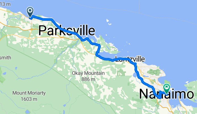
Fahrradtour in Nanaimo, British Columbia, Kanada
- 70,2 km
- Distanz
- 728 m
- Aufstieg
- 728 m
- Abstieg
Day 007 (break) Day 008 Qualicum Beach to Nanaimo, BC
Fahrradtour in Parksville, British Columbia, Kanada
- 53,7 km
- Distanz
- 430 m
- Aufstieg
- 433 m
- Abstieg
Mehr Routen in Kanada
- Windermere Blvd SW, Edmonton to 90 Ave NW, Edmonton
- Kentwood Dr, Red Deer à Bowerponds Recreation Area, Red Deer
- 8 km
- 22 m
- 45 m
- Red Deer, Alberta, Kanada
- Fish Creek - Stoney Bridge - Cranston Ridge - Riverstone - Fish Creek Bridge Loop
- 26,8 km
- 209 m
- 195 m
- Calgary, Alberta, Kanada
- Rue de la Pionnière, Beaupré à Rue de la Pionnière, Beaupré
- 61,6 km
- 465 m
- 468 m
- Beaupré, Québec, Kanada
- Rive-Sud de Montréal, Beauharnois à Rive-Sud de Montréal, Léry
- 3,9 km
- 204 m
- 212 m
- Beauharnois, Québec, Kanada
- Fallsview Blvd, Niagara Falls to Prince Charles Dr S, Welland
- 76,5 km
- 298 m
- 323 m
- Niagara Falls, Ontario, Kanada


