
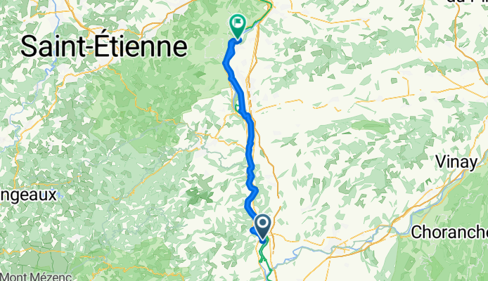
71 bis Rue des Luettes, Tournon-sur-Rhône nach Condrieu
A cycling route starting in Tournon-sur-Rhône, Auvergne-Rhône-Alpes, France.
Overview
About this route
- 21 h 53 min
- Duration
- 68.5 km
- Distance
- 309 m
- Ascent
- 278 m
- Descent
- 3.1 km/h
- Avg. speed
- 153 m
- Avg. speed
Route quality
Waytypes & surfaces along the route
Waytypes
Cycleway
48.2 km
(70 %)
Quiet road
9.3 km
(14 %)
Surfaces
Paved
58.1 km
(85 %)
Unpaved
0.8 km
(1 %)
Asphalt
57.4 km
(84 %)
Gravel
0.6 km
(<1 %)
Continue with Bikemap
Use, edit, or download this cycling route
You would like to ride 71 bis Rue des Luettes, Tournon-sur-Rhône nach Condrieu or customize it for your own trip? Here is what you can do with this Bikemap route:
Free features
- Save this route as favorite or in collections
- Copy & plan your own version of this route
- Sync your route with Garmin or Wahoo
Premium features
Free trial for 3 days, or one-time payment. More about Bikemap Premium.
- Navigate this route on iOS & Android
- Export a GPX / KML file of this route
- Create your custom printout (try it for free)
- Download this route for offline navigation
Discover more Premium features.
Get Bikemap PremiumFrom our community
Other popular routes starting in Tournon-sur-Rhône
 De Avenue Maréchal Foch 13, Tournon-sur-Rhône à Rue Emile Vivion 112, Tain-l'Hermitage
- Distance
- 8.1 km
- Ascent
- 45 m
- Descent
- 51 m
- Location
- Tournon-sur-Rhône, Auvergne-Rhône-Alpes, France
 CrozesHermitagerunde9.5km
- Distance
- 9.5 km
- Ascent
- 124 m
- Descent
- 129 m
- Location
- Tournon-sur-Rhône, Auvergne-Rhône-Alpes, France
 Day 2 ( reworked))
- Distance
- 77.6 km
- Ascent
- 136 m
- Descent
- 170 m
- Location
- Tournon-sur-Rhône, Auvergne-Rhône-Alpes, France
 Route in Tain l'Hermitage
- Distance
- 34.4 km
- Ascent
- 3,482 m
- Descent
- 3,493 m
- Location
- Tournon-sur-Rhône, Auvergne-Rhône-Alpes, France
 From Lamotte-du-Rhône to Avignon
- Distance
- 186.3 km
- Ascent
- 511 m
- Descent
- 609 m
- Location
- Tournon-sur-Rhône, Auvergne-Rhône-Alpes, France
 Via Rhôna:3ème Etappe Tournon à Valence
- Distance
- 24.7 km
- Ascent
- 47 m
- Descent
- 34 m
- Location
- Tournon-sur-Rhône, Auvergne-Rhône-Alpes, France
 Hendaye-Tain-l'Hermitage
- Distance
- 886.9 km
- Ascent
- 3,178 m
- Descent
- 3,282 m
- Location
- Tournon-sur-Rhône, Auvergne-Rhône-Alpes, France
 RW25-W2-ab-Schiff_Sur les Pas de Gambert à Tain-l'Hermitage
- Distance
- 6.8 km
- Ascent
- 259 m
- Descent
- 261 m
- Location
- Tournon-sur-Rhône, Auvergne-Rhône-Alpes, France
Open it in the app