

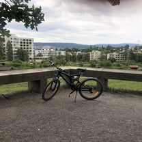
Wollishofen nach Winterthur (Der Weg ist das Ziel)
A cycling route starting in Zürich (Kreis 2) / Wollishofen, Canton of Zurich, Switzerland.
Overview
About this route
Beautiful day trip from Wollishofen to Winterthur via detours. The route leads from Wollishofen over the Irchel to Schwamendingen (Ziegelhütte). Along the edge of the forest, it continues to Stettbach and from there, following the Glatt, to Greifensee. Further on to Pfäffikersee where one has to face the most challenging part of the tour. Then down through a beautiful valley to Töss. Following this, you will soon reach Winterthur. Tip: Do not start the tour too late to avoid too much slaloming at Greifensee.
- -:--
- Duration
- 70.7 km
- Distance
- 353 m
- Ascent
- 380 m
- Descent
- ---
- Avg. speed
- ---
- Max. altitude
Continue with Bikemap
Use, edit, or download this cycling route
You would like to ride Wollishofen nach Winterthur (Der Weg ist das Ziel) or customize it for your own trip? Here is what you can do with this Bikemap route:
Free features
- Save this route as favorite or in collections
- Copy & plan your own version of this route
- Sync your route with Garmin or Wahoo
Premium features
Free trial for 3 days, or one-time payment. More about Bikemap Premium.
- Navigate this route on iOS & Android
- Export a GPX / KML file of this route
- Create your custom printout (try it for free)
- Download this route for offline navigation
Discover more Premium features.
Get Bikemap PremiumFrom our community
Other popular routes starting in Zürich (Kreis 2) / Wollishofen
 Zurich Triathlon Loop
- Distance
- 12.7 km
- Ascent
- 89 m
- Descent
- 91 m
- Location
- Zürich (Kreis 2) / Wollishofen, Canton of Zurich, Switzerland
 Rota relaxada em Zürich
- Distance
- 3.1 km
- Ascent
- 252 m
- Descent
- 251 m
- Location
- Zürich (Kreis 2) / Wollishofen, Canton of Zurich, Switzerland
 Zürich - Ziegelbrücke - Pfäffikon/SZ
- Distance
- 88.5 km
- Ascent
- 159 m
- Descent
- 144 m
- Location
- Zürich (Kreis 2) / Wollishofen, Canton of Zurich, Switzerland
 Ironman Switzerland
- Distance
- 90.2 km
- Ascent
- 537 m
- Descent
- 535 m
- Location
- Zürich (Kreis 2) / Wollishofen, Canton of Zurich, Switzerland
 Wollishofen nach Winterthur (Der Weg ist das Ziel)
- Distance
- 70.7 km
- Ascent
- 353 m
- Descent
- 380 m
- Location
- Zürich (Kreis 2) / Wollishofen, Canton of Zurich, Switzerland
 Ironman Zürich Runde
- Distance
- 176.9 km
- Ascent
- 790 m
- Descent
- 790 m
- Location
- Zürich (Kreis 2) / Wollishofen, Canton of Zurich, Switzerland
 Thujastrasse, Zürich to Thujastrasse, Zürich
- Distance
- 15.7 km
- Ascent
- 271 m
- Descent
- 270 m
- Location
- Zürich (Kreis 2) / Wollishofen, Canton of Zurich, Switzerland
 0. Bahnhof ZH-Jugi-4km
- Distance
- 5.1 km
- Ascent
- 21 m
- Descent
- 39 m
- Location
- Zürich (Kreis 2) / Wollishofen, Canton of Zurich, Switzerland
Open it in the app