
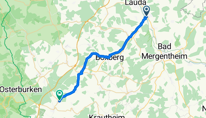
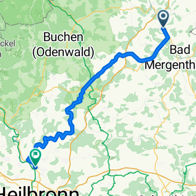
Kirchstraße, Lauda-Königshofen nach Richard-Wagner-Straße, Ravenstein
A cycling route starting in Lauda-Königshofen, Baden-Wurttemberg, Germany.
Overview
About this route
- 1 h 31 min
- Duration
- 25.9 km
- Distance
- 355 m
- Ascent
- 254 m
- Descent
- 17.1 km/h
- Avg. speed
- 395 m
- Max. altitude

Route quality
Waytypes & surfaces along the route
Waytypes
Road
8.5 km
(33 %)
Quiet road
5.7 km
(22 %)
Surfaces
Paved
23.5 km
(91 %)
Asphalt
23.3 km
(90 %)
Paved (undefined)
0.3 km
(1 %)
Undefined
2.3 km
(9 %)
Continue with Bikemap
Use, edit, or download this cycling route
You would like to ride Kirchstraße, Lauda-Königshofen nach Richard-Wagner-Straße, Ravenstein or customize it for your own trip? Here is what you can do with this Bikemap route:
Free features
- Save this route as favorite or in collections
- Copy & plan your own version of this route
- Sync your route with Garmin or Wahoo
Premium features
Free trial for 3 days, or one-time payment. More about Bikemap Premium.
- Navigate this route on iOS & Android
- Export a GPX / KML file of this route
- Create your custom printout (try it for free)
- Download this route for offline navigation
Discover more Premium features.
Get Bikemap PremiumFrom our community
Other popular routes starting in Lauda-Königshofen
 Lauda - Königshofen - Boxberg - Osterburken - Möckmühl - Jagsttal - BFH Schillerstr.
- Distance
- 80.8 km
- Ascent
- 266 m
- Descent
- 289 m
- Location
- Lauda-Königshofen, Baden-Wurttemberg, Germany
 Frankenrunde Tauber zum Main und zurück CLONED FROM ROUTE 288271
- Distance
- 97.4 km
- Ascent
- 846 m
- Descent
- 855 m
- Location
- Lauda-Königshofen, Baden-Wurttemberg, Germany
 Baulandrunde
- Distance
- 57.2 km
- Ascent
- 614 m
- Descent
- 603 m
- Location
- Lauda-Königshofen, Baden-Wurttemberg, Germany
 MTB Lauda Römerweg-Osterloch Runde
- Distance
- 39.9 km
- Ascent
- 596 m
- Descent
- 596 m
- Location
- Lauda-Königshofen, Baden-Wurttemberg, Germany
 kurze Bergsprints
- Distance
- 14.3 km
- Ascent
- 133 m
- Descent
- 90 m
- Location
- Lauda-Königshofen, Baden-Wurttemberg, Germany
 N° 1 | E-Bike Teststrecke auf den Schmachtenberg
- Distance
- 8.8 km
- Ascent
- 142 m
- Descent
- 139 m
- Location
- Lauda-Königshofen, Baden-Wurttemberg, Germany
 Lauda-Tauberbrücke Erlebnistour
- Distance
- 39.7 km
- Ascent
- 343 m
- Descent
- 343 m
- Location
- Lauda-Königshofen, Baden-Wurttemberg, Germany
 MTB Lauda 07-19
- Distance
- 33.7 km
- Ascent
- 369 m
- Descent
- 363 m
- Location
- Lauda-Königshofen, Baden-Wurttemberg, Germany
Open it in the app