

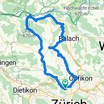
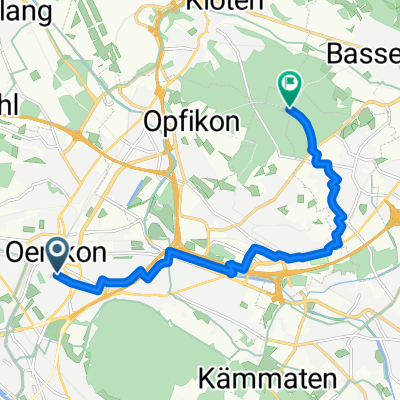
Kaiserstuhl via Glattradweg
A cycling route starting in Zürich (Kreis 11) / Oerlikon, Canton of Zurich, Switzerland.
Overview
About this route
- 3 h 38 min
- Duration
- 62.8 km
- Distance
- 670 m
- Ascent
- 671 m
- Descent
- 17.3 km/h
- Avg. speed
- 529 m
- Max. altitude

Route quality
Waytypes & surfaces along the route
Waytypes
Track
20.7 km
(33 %)
Quiet road
11.9 km
(19 %)
Surfaces
Paved
52.1 km
(83 %)
Unpaved
3.8 km
(6 %)
Asphalt
51.5 km
(82 %)
Gravel
3.8 km
(6 %)
Continue with Bikemap
Use, edit, or download this cycling route
You would like to ride Kaiserstuhl via Glattradweg or customize it for your own trip? Here is what you can do with this Bikemap route:
Free features
- Save this route as favorite or in collections
- Copy & plan your own version of this route
- Sync your route with Garmin or Wahoo
Premium features
Free trial for 3 days, or one-time payment. More about Bikemap Premium.
- Navigate this route on iOS & Android
- Export a GPX / KML file of this route
- Create your custom printout (try it for free)
- Download this route for offline navigation
Discover more Premium features.
Get Bikemap PremiumFrom our community
Other popular routes starting in Zürich (Kreis 11) / Oerlikon
 Kleine+1 Tour Richtung Uster
- Distance
- 44.9 km
- Ascent
- 226 m
- Descent
- 231 m
- Location
- Zürich (Kreis 11) / Oerlikon, Canton of Zurich, Switzerland
 Flughafen_Baden_v2_69km
- Distance
- 69.5 km
- Ascent
- 191 m
- Descent
- 662 m
- Location
- Zürich (Kreis 11) / Oerlikon, Canton of Zurich, Switzerland
 Sternenberg Rundfahrt
- Distance
- 102.7 km
- Ascent
- 798 m
- Descent
- 791 m
- Location
- Zürich (Kreis 11) / Oerlikon, Canton of Zurich, Switzerland
 Kaiserstuhl via Glattradweg
- Distance
- 62.8 km
- Ascent
- 670 m
- Descent
- 671 m
- Location
- Zürich (Kreis 11) / Oerlikon, Canton of Zurich, Switzerland
 Lange Radrunde durch Zürich
- Distance
- 37.4 km
- Ascent
- 179 m
- Descent
- 180 m
- Location
- Zürich (Kreis 11) / Oerlikon, Canton of Zurich, Switzerland
 Hofwiesenstrasse to Partizanska cesta
- Distance
- 849.6 km
- Ascent
- 1,860 m
- Descent
- 2,074 m
- Location
- Zürich (Kreis 11) / Oerlikon, Canton of Zurich, Switzerland
 Oerlikon nach Suhr (Tag1)
- Distance
- 68.3 km
- Ascent
- 342 m
- Descent
- 392 m
- Location
- Zürich (Kreis 11) / Oerlikon, Canton of Zurich, Switzerland
 Von Zürich bis Dietlikon
- Distance
- 10.7 km
- Ascent
- 92 m
- Descent
- 51 m
- Location
- Zürich (Kreis 11) / Oerlikon, Canton of Zurich, Switzerland
Open it in the app