
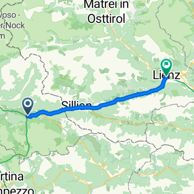
Alpenüberquerung: München - Venedig
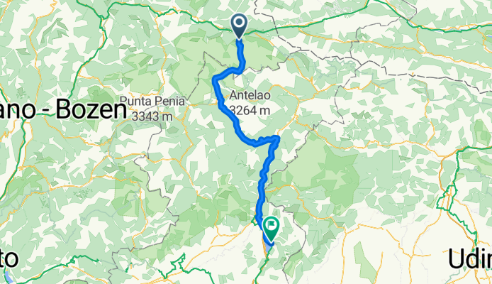
Etappe 5: Toblachersee - Lago di Santa Croce
A cycling route starting in Toblach, Trentino-Alto Adige, Italy.
Overview
About this route
- 6 h 40 min
- Duration
- 104.1 km
- Distance
- 2,019 m
- Ascent
- 2,900 m
- Descent
- 15.6 km/h
- Avg. speed
- 1,535 m
- Max. altitude

Part of
Route quality
Waytypes & surfaces along the route
Waytypes
Cycleway
57.3 km
(55 %)
Quiet road
11.5 km
(11 %)
Surfaces
Paved
72.9 km
(70 %)
Unpaved
26 km
(25 %)
Asphalt
72.9 km
(70 %)
Gravel
20.8 km
(20 %)
Continue with Bikemap
Use, edit, or download this cycling route
You would like to ride Etappe 5: Toblachersee - Lago di Santa Croce or customize it for your own trip? Here is what you can do with this Bikemap route:
Free features
- Save this route as favorite or in collections
- Copy & plan your own version of this route
- Split it into stages to create a multi-day tour
- Sync your route with Garmin or Wahoo
Premium features
Free trial for 3 days, or one-time payment. More about Bikemap Premium.
- Navigate this route on iOS & Android
- Export a GPX / KML file of this route
- Create your custom printout (try it for free)
- Download this route for offline navigation
Discover more Premium features.
Get Bikemap PremiumFrom our community
Other popular routes starting in Toblach
![Drava Cycle Route (Drauradweg) - Austria [Cycling Thread] - Cycling Thread - Carinthia 2021](https://media.bikemap.net/routes/17609068/staticmaps/in_b4187b65-f8bd-4c87-9cab-3a8b7ed6db61_400x400_bikemap-2021-3D-static.png) Drava Cycle Route (Drauradweg) - Austria [Cycling Thread] - Cycling Thread - Carinthia 2021
Drava Cycle Route (Drauradweg) - Austria [Cycling Thread] - Cycling Thread - Carinthia 2021- Distance
- 288.9 km
- Ascent
- 556,252 m
- Descent
- 555,790 m
- Location
- Toblach, Trentino-Alto Adige, Italy
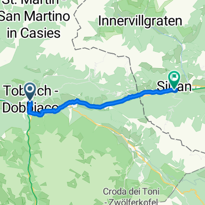 Toblach - Abfaltersbach
- Distance
- 18.5 km
- Ascent
- 83 m
- Descent
- 238 m
- Location
- Toblach, Trentino-Alto Adige, Italy
 Viale Stazione, Dobbiaco a Amlacher Straße, Lienz
- Distance
- 49.2 km
- Ascent
- 107 m
- Descent
- 639 m
- Location
- Toblach, Trentino-Alto Adige, Italy
 Toblach-Lienz: der Drauradweg
- Distance
- 48 km
- Ascent
- 358 m
- Descent
- 893 m
- Location
- Toblach, Trentino-Alto Adige, Italy
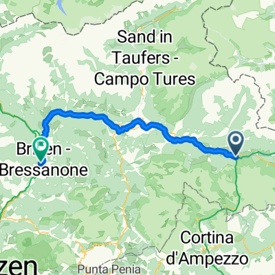
 DOBBIACO CORTINA
- Distance
- 70.6 km
- Ascent
- 845 m
- Descent
- 865 m
- Location
- Toblach, Trentino-Alto Adige, Italy
 Drava Cycle Route - Toblach to Aich/Dob
- Distance
- 288.3 km
- Ascent
- 2,961 m
- Descent
- 3,722 m
- Location
- Toblach, Trentino-Alto Adige, Italy
 Toblach-Bruneck-Brixen: der Pustertalradweg
- Distance
- 66.6 km
- Ascent
- 481 m
- Descent
- 1,123 m
- Location
- Toblach, Trentino-Alto Adige, Italy
 Bahnhofstraße 3a nach Bahnhofsplatz
- Distance
- 49.1 km
- Ascent
- 458 m
- Descent
- 993 m
- Location
- Toblach, Trentino-Alto Adige, Italy
Open it in the app