
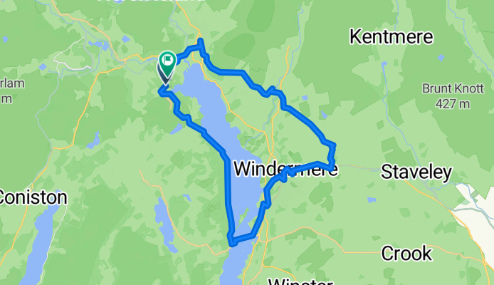
Skelwith Fold road end to Skelwith Fold road end
A cycling route starting in Ambleside, England, United Kingdom.
Overview
About this route
- 2 h 35 min
- Duration
- 29.1 km
- Distance
- 567 m
- Ascent
- 569 m
- Descent
- 11.3 km/h
- Avg. speed
- 240 m
- Max. altitude
Route quality
Waytypes & surfaces along the route
Waytypes
Cycleway
11.1 km
(38 %)
Quiet road
10.8 km
(37 %)
Surfaces
Paved
10.8 km
(37 %)
Unpaved
11.1 km
(38 %)
Asphalt
10.5 km
(36 %)
Gravel
10.2 km
(35 %)
Continue with Bikemap
Use, edit, or download this cycling route
You would like to ride Skelwith Fold road end to Skelwith Fold road end or customize it for your own trip? Here is what you can do with this Bikemap route:
Free features
- Save this route as favorite or in collections
- Copy & plan your own version of this route
- Sync your route with Garmin or Wahoo
Premium features
Free trial for 3 days, or one-time payment. More about Bikemap Premium.
- Navigate this route on iOS & Android
- Export a GPX / KML file of this route
- Create your custom printout (try it for free)
- Download this route for offline navigation
Discover more Premium features.
Get Bikemap PremiumFrom our community
Other popular routes starting in Ambleside
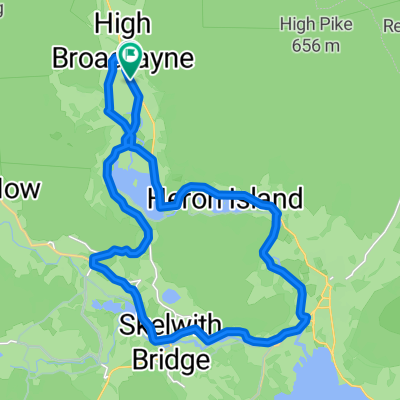
 Grizedale i dookoła Coniston Water.
- Distance
- 46.7 km
- Ascent
- 619 m
- Descent
- 628 m
- Location
- Ambleside, England, United Kingdom
 Wigton - Ambleside
- Distance
- 70.7 km
- Ascent
- 1,425 m
- Descent
- 1,580 m
- Location
- Ambleside, England, United Kingdom
 Fred Whitton Challenge, 9 May 2010
- Distance
- 172.6 km
- Ascent
- 1,826 m
- Descent
- 1,822 m
- Location
- Ambleside, England, United Kingdom
 Fred Whitton Challenge, 9 May 2010 CLONED FROM ROUTE 724662
- Distance
- 172.6 km
- Ascent
- 1,870 m
- Descent
- 1,862 m
- Location
- Ambleside, England, United Kingdom
 Actually Modifed Coniston/Windemere loop
- Distance
- 52.8 km
- Ascent
- 557 m
- Descent
- 554 m
- Location
- Ambleside, England, United Kingdom
 Not Hard and Dry Nose
- Distance
- 41.5 km
- Ascent
- 831 m
- Descent
- 831 m
- Location
- Ambleside, England, United Kingdom
 B5286, Ambleside do Cooksons Garth, Ambleside
- Distance
- 29.5 km
- Ascent
- 459 m
- Descent
- 459 m
- Location
- Ambleside, England, United Kingdom
 Grasmere loop - Rydal, Ambleside, Skelwith and Elterwater
- Distance
- 21 km
- Ascent
- 208 m
- Descent
- 210 m
- Location
- Ambleside, England, United Kingdom
Open it in the app