
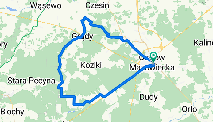
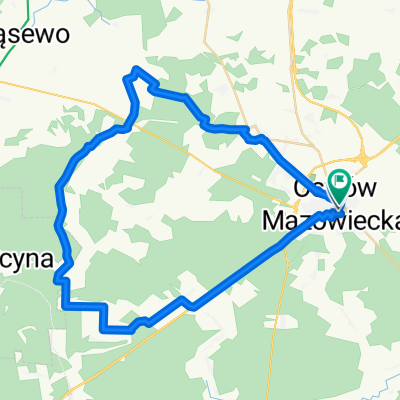
Onufrego Zagłoby do Onufrego Zagłoby
A cycling route starting in Ostrów Mazowiecka, Masovian Voivodeship, Poland.
Overview
About this route
- 2 h 52 min
- Duration
- 46.2 km
- Distance
- 163 m
- Ascent
- 162 m
- Descent
- 16.1 km/h
- Avg. speed
- 138 m
- Max. altitude

Route quality
Waytypes & surfaces along the route
Waytypes
Quiet road
22.6 km
(49 %)
Track
10.6 km
(23 %)
Surfaces
Paved
33.2 km
(72 %)
Unpaved
2.3 km
(5 %)
Asphalt
30.5 km
(66 %)
Paved (undefined)
2.8 km
(6 %)
Continue with Bikemap
Use, edit, or download this cycling route
You would like to ride Onufrego Zagłoby do Onufrego Zagłoby or customize it for your own trip? Here is what you can do with this Bikemap route:
Free features
- Save this route as favorite or in collections
- Copy & plan your own version of this route
- Sync your route with Garmin or Wahoo
Premium features
Free trial for 3 days, or one-time payment. More about Bikemap Premium.
- Navigate this route on iOS & Android
- Export a GPX / KML file of this route
- Create your custom printout (try it for free)
- Download this route for offline navigation
Discover more Premium features.
Get Bikemap PremiumFrom our community
Other popular routes starting in Ostrów Mazowiecka
 Trip from Komorowo to Brok (and back again)
- Distance
- 19.5 km
- Ascent
- 52 m
- Descent
- 82 m
- Location
- Ostrów Mazowiecka, Masovian Voivodeship, Poland
 Onufrego Zagłoby do Onufrego Zagłoby
- Distance
- 46.2 km
- Ascent
- 163 m
- Descent
- 162 m
- Location
- Ostrów Mazowiecka, Masovian Voivodeship, Poland
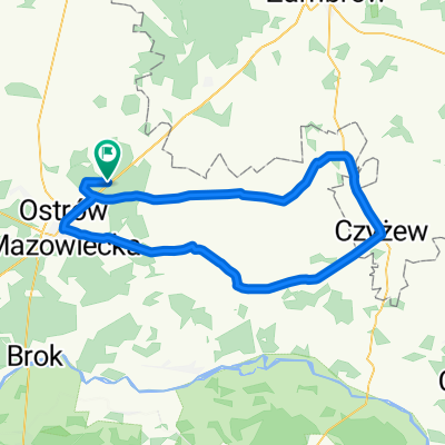 Podborze-Króle-Andrzejewo-ZarebyWarchoły-Czyżew-SzulborzeWielkie-Zaręby-Nieskórz-Ostrów-Podborze
- Distance
- 75.2 km
- Ascent
- 130 m
- Descent
- 130 m
- Location
- Ostrów Mazowiecka, Masovian Voivodeship, Poland
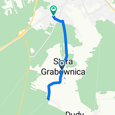 Stara Grabownica 61, Ostrów Mazowiecka do Leśna 24, Ostrów Mazowiecka
- Distance
- 5.3 km
- Ascent
- 34 m
- Descent
- 19 m
- Location
- Ostrów Mazowiecka, Masovian Voivodeship, Poland
 Długosiodło - tam/powrót 70km
- Distance
- 70.1 km
- Ascent
- 86 m
- Descent
- 84 m
- Location
- Ostrów Mazowiecka, Masovian Voivodeship, Poland
 szczurów
- Distance
- 99.9 km
- Ascent
- 934 m
- Descent
- 933 m
- Location
- Ostrów Mazowiecka, Masovian Voivodeship, Poland
 Dojaz do Zaręby Jartuzy na pętlę Szumowo
- Distance
- 14.3 km
- Ascent
- 54 m
- Descent
- 58 m
- Location
- Ostrów Mazowiecka, Masovian Voivodeship, Poland
 Wiśniowa 41–49, Ostrów Mazowiecka do Tadeusza Kościuszki 38B, Ostrów Mazowiecka
- Distance
- 5.7 km
- Ascent
- 38 m
- Descent
- 22 m
- Location
- Ostrów Mazowiecka, Masovian Voivodeship, Poland
Open it in the app