
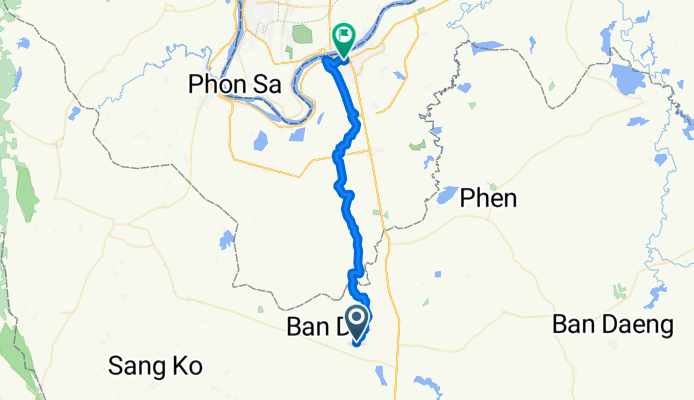
Overview
About this route
- 3 h 10 min
- Duration
- 49.8 km
- Distance
- 128 m
- Ascent
- 138 m
- Descent
- 15.7 km/h
- Avg. speed
- 194 m
- Max. altitude

Part of
Ayutthaya - Nong Khai
9 stages
Route quality
Waytypes & surfaces along the route
Waytypes
Quiet road
30.4 km
(61 %)
Track
6.5 km
(13 %)
Surfaces
Paved
1 km
(2 %)
Unpaved
7 km
(14 %)
Unpaved (undefined)
7 km
(14 %)
Concrete
1 km
(2 %)
Undefined
41.9 km
(84 %)
Continue with Bikemap
Use, edit, or download this cycling route
You would like to ride Sa Khrai - Nong Khai or customize it for your own trip? Here is what you can do with this Bikemap route:
Free features
- Save this route as favorite or in collections
- Copy & plan your own version of this route
- Sync your route with Garmin or Wahoo
Premium features
Free trial for 3 days, or one-time payment. More about Bikemap Premium.
- Navigate this route on iOS & Android
- Export a GPX / KML file of this route
- Create your custom printout (try it for free)
- Download this route for offline navigation
Discover more Premium features.
Get Bikemap PremiumFrom our community
Other popular routes starting in Sa Khrai
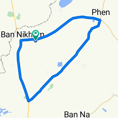 Amper pen circle 43 km
- Distance
- 43.1 km
- Ascent
- 84 m
- Descent
- 85 m
- Location
- Sa Khrai, Nong Khai, Thailand
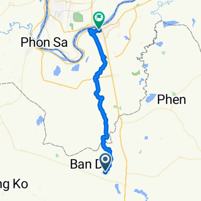 Sa Khrai - Nong Khai
- Distance
- 49.8 km
- Ascent
- 128 m
- Descent
- 138 m
- Location
- Sa Khrai, Nong Khai, Thailand
Open it in the app