
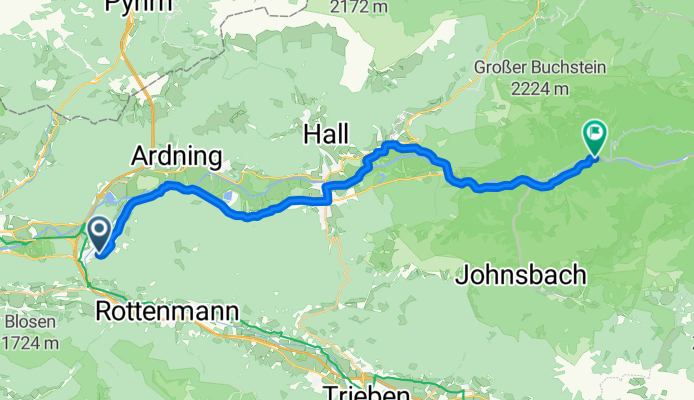
Selzthal Gstatterboden
A cycling route starting in Selzthal, Styria, Austria.
Overview
About this route
- 2 h 3 min
- Duration
- 30.9 km
- Distance
- 919 m
- Ascent
- 979 m
- Descent
- 15.1 km/h
- Avg. speed
- 720 m
- Max. altitude

Route quality
Waytypes & surfaces along the route
Waytypes
Road
16.1 km
(52 %)
Cycleway
5.6 km
(18 %)
Surfaces
Paved
15.8 km
(51 %)
Unpaved
1.2 km
(4 %)
Asphalt
15.8 km
(51 %)
Gravel
1.2 km
(4 %)
Undefined
13.9 km
(45 %)
Continue with Bikemap
Use, edit, or download this cycling route
You would like to ride Selzthal Gstatterboden or customize it for your own trip? Here is what you can do with this Bikemap route:
Free features
- Save this route as favorite or in collections
- Copy & plan your own version of this route
- Sync your route with Garmin or Wahoo
Premium features
Free trial for 3 days, or one-time payment. More about Bikemap Premium.
- Navigate this route on iOS & Android
- Export a GPX / KML file of this route
- Create your custom printout (try it for free)
- Download this route for offline navigation
Discover more Premium features.
Get Bikemap PremiumFrom our community
Other popular routes starting in Selzthal
 Grünes Herz Tour 2020
- Distance
- 342 km
- Ascent
- 8,289 m
- Descent
- 8,657 m
- Location
- Selzthal, Styria, Austria
 2011 Selzthal-Hieflau,durchs Gesäuse
- Distance
- 56.7 km
- Ascent
- 678 m
- Descent
- 820 m
- Location
- Selzthal, Styria, Austria
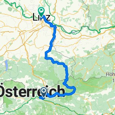 Ennstalradweg Selzthal Linz
- Distance
- 194.7 km
- Ascent
- 4,567 m
- Descent
- 4,951 m
- Location
- Selzthal, Styria, Austria
 Selzthaler Radmarathon Familienstrecke
- Distance
- 15.7 km
- Ascent
- 103 m
- Descent
- 104 m
- Location
- Selzthal, Styria, Austria
 Selzthal Gstatterboden
- Distance
- 30.9 km
- Ascent
- 919 m
- Descent
- 979 m
- Location
- Selzthal, Styria, Austria
 selzthal-zagreb
- Distance
- 349.7 km
- Ascent
- 510 m
- Descent
- 1,009 m
- Location
- Selzthal, Styria, Austria
 Grünes Herz 2021
- Distance
- 374.4 km
- Ascent
- 8,139 m
- Descent
- 8,455 m
- Location
- Selzthal, Styria, Austria
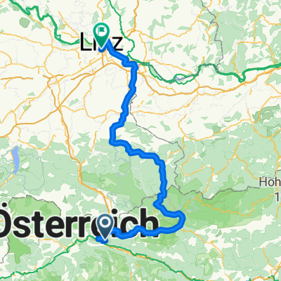 Ennstalradweg
- Distance
- 199.1 km
- Ascent
- 4,573 m
- Descent
- 4,943 m
- Location
- Selzthal, Styria, Austria
Open it in the app