
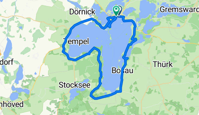
Plöner-See-Tour
A cycling route starting in Plön, Schleswig-Holstein, Germany.
Overview
About this route
- 2 h 39 min
- Duration
- 41.1 km
- Distance
- 325 m
- Ascent
- 325 m
- Descent
- 15.5 km/h
- Avg. speed
- 51 m
- Max. altitude

Continue with Bikemap
Use, edit, or download this cycling route
You would like to ride Plöner-See-Tour or customize it for your own trip? Here is what you can do with this Bikemap route:
Free features
- Save this route as favorite or in collections
- Copy & plan your own version of this route
- Sync your route with Garmin or Wahoo
Premium features
Free trial for 3 days, or one-time payment. More about Bikemap Premium.
- Navigate this route on iOS & Android
- Export a GPX / KML file of this route
- Create your custom printout (try it for free)
- Download this route for offline navigation
Discover more Premium features.
Get Bikemap PremiumFrom our community
Other popular routes starting in Plön
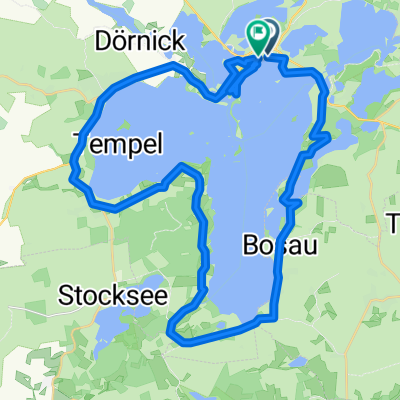
 Plöner-See-Tour 1. Mai 2025_mod
- Distance
- 41.9 km
- Ascent
- 104 m
- Descent
- 106 m
- Location
- Plön, Schleswig-Holstein, Germany
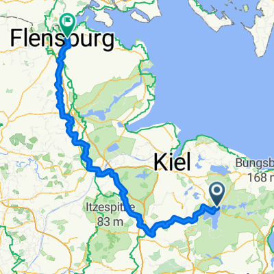 Von Plön bis Flensburg
- Distance
- 179 km
- Ascent
- 428 m
- Descent
- 418 m
- Location
- Plön, Schleswig-Holstein, Germany
 Behl-Benz-Kaköhl-Hohwacht-Rantzau
- Distance
- 80.1 km
- Ascent
- 335 m
- Descent
- 334 m
- Location
- Plön, Schleswig-Holstein, Germany
 Ascheberger Straße 1a, Plön nach Ascheberger Straße 1a, Plön
- Distance
- 25 km
- Ascent
- 57 m
- Descent
- 103 m
- Location
- Plön, Schleswig-Holstein, Germany
 Plöner Seen Tour 70km
- Distance
- 69.1 km
- Ascent
- 464 m
- Descent
- 456 m
- Location
- Plön, Schleswig-Holstein, Germany
 Plöner Seen Tour
- Distance
- 67.4 km
- Ascent
- 239 m
- Descent
- 239 m
- Location
- Plön, Schleswig-Holstein, Germany
 Plön, Kleine Mühlentour
- Distance
- 26.1 km
- Ascent
- 177 m
- Descent
- 182 m
- Location
- Plön, Schleswig-Holstein, Germany
 Plöner-See-Tour
- Distance
- 41.1 km
- Ascent
- 325 m
- Descent
- 325 m
- Location
- Plön, Schleswig-Holstein, Germany
Open it in the app