
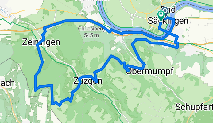
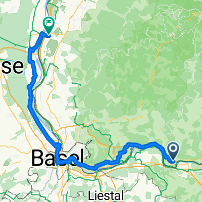
Hauensteinstraße nach Hauensteinstraße
A cycling route starting in Stein, Canton of Aargau, Switzerland.
Overview
About this route
- 2 h
- Duration
- 26 km
- Distance
- 719 m
- Ascent
- 722 m
- Descent
- 13 km/h
- Avg. speed
- 577 m
- Max. altitude
Route quality
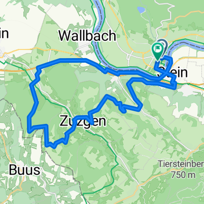
Waytypes & surfaces along the route
Waytypes
Quiet road
15.3 km
(59 %)
Track
5.2 km
(20 %)
Surfaces
Paved
18.5 km
(71 %)
Unpaved
6.5 km
(25 %)
Asphalt
18.2 km
(70 %)
Gravel
6.5 km
(25 %)
Continue with Bikemap
Use, edit, or download this cycling route
You would like to ride Hauensteinstraße nach Hauensteinstraße or customize it for your own trip? Here is what you can do with this Bikemap route:
Free features
- Save this route as favorite or in collections
- Copy & plan your own version of this route
- Sync your route with Garmin or Wahoo
Premium features
Free trial for 3 days, or one-time payment. More about Bikemap Premium.
- Navigate this route on iOS & Android
- Export a GPX / KML file of this route
- Create your custom printout (try it for free)
- Download this route for offline navigation
Discover more Premium features.
Get Bikemap PremiumFrom our community
Other popular routes starting in Stein
 Hauensteinstraße nach Hauensteinstraße
- Distance
- 26 km
- Ascent
- 719 m
- Descent
- 722 m
- Location
- Stein, Canton of Aargau, Switzerland
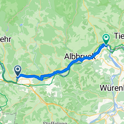
 Erste Tour von Wehr nach Laufenburg
- Distance
- 32.9 km
- Ascent
- 503 m
- Descent
- 479 m
- Location
- Stein, Canton of Aargau, Switzerland
 Gippingen - Buch - Niederwihl
- Distance
- 80.1 km
- Ascent
- 779 m
- Descent
- 780 m
- Location
- Stein, Canton of Aargau, Switzerland
 Stein - Weisweil
- Distance
- 131.9 km
- Ascent
- 0 m
- Descent
- 137 m
- Location
- Stein, Canton of Aargau, Switzerland
 Basel - Koblenz AG
- Distance
- 25.4 km
- Ascent
- 149 m
- Descent
- 131 m
- Location
- Stein, Canton of Aargau, Switzerland
 Gippingen - Albruck - Hottingen - Hornberg - Bergalingen
- Distance
- 99.7 km
- Ascent
- 1,056 m
- Descent
- 1,056 m
- Location
- Stein, Canton of Aargau, Switzerland
 Rhein - Aare - Fahrradtour
- Distance
- 86.3 km
- Ascent
- 524 m
- Descent
- 523 m
- Location
- Stein, Canton of Aargau, Switzerland
 Tag 12 : Weihermatten, Bad Säckingen nach Kreuzstraße, Neuenburg am Rhein
- Distance
- 76.5 km
- Ascent
- 263 m
- Descent
- 344 m
- Location
- Stein, Canton of Aargau, Switzerland
Open it in the app