
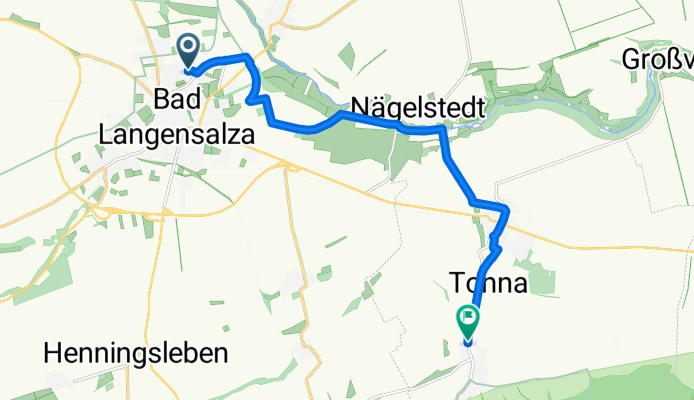
Von Bad Langensalza bis Tonna
A cycling route starting in Bad Langensalza, Thuringia, Germany.
Overview
About this route
- 39 min
- Duration
- 11.3 km
- Distance
- 59 m
- Ascent
- 35 m
- Descent
- 17.2 km/h
- Avg. speed
- 209 m
- Max. altitude

Route quality
Waytypes & surfaces along the route
Waytypes
Access road
2.9 km
(26 %)
Track
2.9 km
(26 %)
Surfaces
Paved
11.1 km
(98 %)
Unpaved
0.1 km
(1 %)
Asphalt
8.8 km
(78 %)
Concrete
1.9 km
(17 %)
Continue with Bikemap
Use, edit, or download this cycling route
You would like to ride Von Bad Langensalza bis Tonna or customize it for your own trip? Here is what you can do with this Bikemap route:
Free features
- Save this route as favorite or in collections
- Copy & plan your own version of this route
- Sync your route with Garmin or Wahoo
Premium features
Free trial for 3 days, or one-time payment. More about Bikemap Premium.
- Navigate this route on iOS & Android
- Export a GPX / KML file of this route
- Create your custom printout (try it for free)
- Download this route for offline navigation
Discover more Premium features.
Get Bikemap PremiumFrom our community
Other popular routes starting in Bad Langensalza
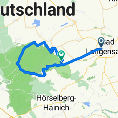
 Durch den Hainich
- Distance
- 63.5 km
- Ascent
- 392 m
- Descent
- 319 m
- Location
- Bad Langensalza, Thuringia, Germany
 Bad Langensalzalza nach Sömmerda
- Distance
- 46.5 km
- Ascent
- 144 m
- Descent
- 187 m
- Location
- Bad Langensalza, Thuringia, Germany
 Bad Langensalza - Baumkronenpfad
- Distance
- 11.3 km
- Ascent
- 163 m
- Descent
- 0 m
- Location
- Bad Langensalza, Thuringia, Germany
 Von Bad Langensalza bis Schönstedt
- Distance
- 33.1 km
- Ascent
- 483 m
- Descent
- 380 m
- Location
- Bad Langensalza, Thuringia, Germany
 Von Bad Langensalza bis Tonna
- Distance
- 11.3 km
- Ascent
- 59 m
- Descent
- 35 m
- Location
- Bad Langensalza, Thuringia, Germany
 19_Bad Langensalza – Sömmerda
- Distance
- 43.8 km
- Ascent
- 95 m
- Descent
- 140 m
- Location
- Bad Langensalza, Thuringia, Germany
 LSZ - SW-Runde 1
- Distance
- 21.6 km
- Ascent
- 197 m
- Descent
- 200 m
- Location
- Bad Langensalza, Thuringia, Germany
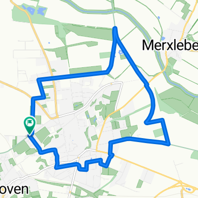 Route in Bad Langensalza
- Distance
- 10.2 km
- Ascent
- 71 m
- Descent
- 71 m
- Location
- Bad Langensalza, Thuringia, Germany
Open it in the app