
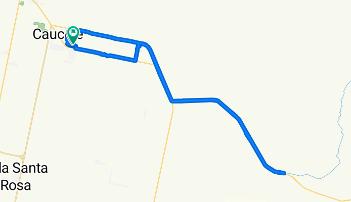
objetivo 38
A cycling route starting in Caucete, San Juan Province, Argentina.
Overview
About this route
- 2 h 58 min
- Duration
- 46.5 km
- Distance
- 522 m
- Ascent
- 523 m
- Descent
- 15.6 km/h
- Avg. speed
- 648 m
- Max. altitude
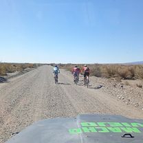
Route photos


Continue with Bikemap
Use, edit, or download this cycling route
You would like to ride objetivo 38 or customize it for your own trip? Here is what you can do with this Bikemap route:
Free features
- Save this route as favorite or in collections
- Copy & plan your own version of this route
- Sync your route with Garmin or Wahoo
Premium features
Free trial for 3 days, or one-time payment. More about Bikemap Premium.
- Navigate this route on iOS & Android
- Export a GPX / KML file of this route
- Create your custom printout (try it for free)
- Download this route for offline navigation
Discover more Premium features.
Get Bikemap PremiumFrom our community
Other popular routes starting in Caucete
 De Laprida a José M. Estrada
- Distance
- 395.9 km
- Ascent
- 6,949 m
- Descent
- 6,941 m
- Location
- Caucete, San Juan Province, Argentina
 objetivo 45
- Distance
- 43.7 km
- Ascent
- 292 m
- Descent
- 337 m
- Location
- Caucete, San Juan Province, Argentina
 objetivo 22
- Distance
- 42.5 km
- Ascent
- 475 m
- Descent
- 507 m
- Location
- Caucete, San Juan Province, Argentina
 objetivo 38
- Distance
- 46.5 km
- Ascent
- 522 m
- Descent
- 523 m
- Location
- Caucete, San Juan Province, Argentina
 san ceferino
- Distance
- 27.4 km
- Ascent
- 397 m
- Descent
- 397 m
- Location
- Caucete, San Juan Province, Argentina
 objetivo 23
- Distance
- 45 km
- Ascent
- 458 m
- Descent
- 482 m
- Location
- Caucete, San Juan Province, Argentina
 objetivo 39
- Distance
- 28.8 km
- Ascent
- 226 m
- Descent
- 253 m
- Location
- Caucete, San Juan Province, Argentina
 objetivo 22
- Distance
- 29.3 km
- Ascent
- 495 m
- Descent
- 530 m
- Location
- Caucete, San Juan Province, Argentina
Open it in the app