

fraham, Donau, hinzenbach
A cycling route starting in Bad Schallerbach, Upper Austria, Austria.
Overview
About this route
- 2 h 23 min
- Duration
- 41.5 km
- Distance
- 118 m
- Ascent
- 130 m
- Descent
- 17.4 km/h
- Avg. speed
- 330 m
- Max. altitude

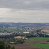
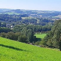
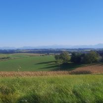
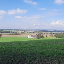
Route photos


Route quality
Waytypes & surfaces along the route
Waytypes
Quiet road
25.7 km
(62 %)
Road
5.8 km
(14 %)
Surfaces
Paved
13.7 km
(33 %)
Unpaved
0.8 km
(2 %)
Asphalt
13.7 km
(33 %)
Gravel
0.8 km
(2 %)
Undefined
27 km
(65 %)
Continue with Bikemap
Use, edit, or download this cycling route
You would like to ride fraham, Donau, hinzenbach or customize it for your own trip? Here is what you can do with this Bikemap route:
Free features
- Save this route as favorite or in collections
- Copy & plan your own version of this route
- Sync your route with Garmin or Wahoo
Premium features
Free trial for 3 days, or one-time payment. More about Bikemap Premium.
- Navigate this route on iOS & Android
- Export a GPX / KML file of this route
- Create your custom printout (try it for free)
- Download this route for offline navigation
Discover more Premium features.
Get Bikemap PremiumFrom our community
Other popular routes starting in Bad Schallerbach
 puchberg, fernreith, gferet, müllerberg
- Distance
- 34.5 km
- Ascent
- 361 m
- Descent
- 426 m
- Location
- Bad Schallerbach, Upper Austria, Austria
 stroheim
- Distance
- 40.2 km
- Ascent
- 547 m
- Descent
- 607 m
- Location
- Bad Schallerbach, Upper Austria, Austria
 stadlhof, Vogel Strauß und retour
- Distance
- 26.5 km
- Ascent
- 213 m
- Descent
- 258 m
- Location
- Bad Schallerbach, Upper Austria, Austria
 scharten, axberg, polsing
- Distance
- 39.4 km
- Ascent
- 310 m
- Descent
- 354 m
- Location
- Bad Schallerbach, Upper Austria, Austria
 scharten Runde
- Distance
- 30.1 km
- Ascent
- 244 m
- Descent
- 297 m
- Location
- Bad Schallerbach, Upper Austria, Austria
 buchkirchen, mistlbach, axberg, polsing, scharten
- Distance
- 41.4 km
- Ascent
- 550 m
- Descent
- 569 m
- Location
- Bad Schallerbach, Upper Austria, Austria
 grieskirchen, St.Georgen, meggenhofen, gallspach, dingbach
- Distance
- 44.1 km
- Ascent
- 351 m
- Descent
- 401 m
- Location
- Bad Schallerbach, Upper Austria, Austria
 pöttting, waizenkirchen, sommersberg
- Distance
- 51.4 km
- Ascent
- 481 m
- Descent
- 529 m
- Location
- Bad Schallerbach, Upper Austria, Austria
Open it in the app