
Kelsterbach - Zülpich
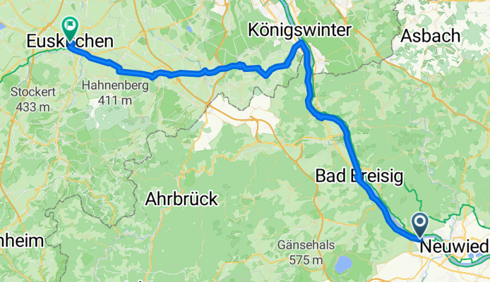
Weißenthurm - Wachtberg
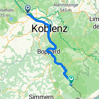
A cycling route starting in Andernach, Rhineland-Palatinate, Germany.
Overview
About this route
- 4 h 23 min
- Duration
- 70.7 km
- Distance
- 584 m
- Ascent
- 486 m
- Descent
- 16.1 km/h
- Avg. speed
- 231 m
- Max. altitude
Part of
Kelsterbach - Zülpich
5 stages
Route quality
Waytypes & surfaces along the route
Waytypes
Path
43.8 km
(62 %)
Quiet road
17.7 km
(25 %)
Surfaces
Paved
53.7 km
(76 %)
Asphalt
53.7 km
(76 %)
Undefined
17 km
(24 %)
Continue with Bikemap
Use, edit, or download this cycling route
You would like to ride Weißenthurm - Wachtberg or customize it for your own trip? Here is what you can do with this Bikemap route:
Free features
- Save this route as favorite or in collections
- Copy & plan your own version of this route
- Sync your route with Garmin or Wahoo
Premium features
Free trial for 3 days, or one-time payment. More about Bikemap Premium.
- Navigate this route on iOS & Android
- Export a GPX / KML file of this route
- Create your custom printout (try it for free)
- Download this route for offline navigation
Discover more Premium features.
Get Bikemap PremiumFrom our community
Other popular routes starting in Andernach
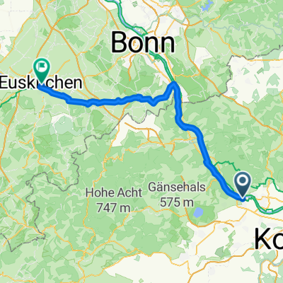 Andernach - Euskirchen
- Distance
- 71.1 km
- Ascent
- 596 m
- Descent
- 500 m
- Location
- Andernach, Rhineland-Palatinate, Germany
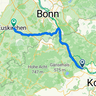
 Andernach - Euskirchen
- Distance
- 70.1 km
- Ascent
- 585 m
- Descent
- 506 m
- Location
- Andernach, Rhineland-Palatinate, Germany
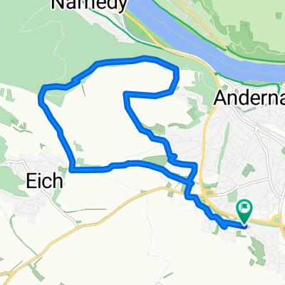
 Grosse Brexbachrunde
- Distance
- 56.9 km
- Ascent
- 1,018 m
- Descent
- 1,018 m
- Location
- Andernach, Rhineland-Palatinate, Germany
 Hochstraße nach Thermenallee
- Distance
- 70.1 km
- Ascent
- 578 m
- Descent
- 490 m
- Location
- Andernach, Rhineland-Palatinate, Germany
 TBAB MTB Feierabendrunde
- Distance
- 11.9 km
- Ascent
- 230 m
- Descent
- 218 m
- Location
- Andernach, Rhineland-Palatinate, Germany
 De Konrad-Adenauer-Allee a Erzbergerufer
- Distance
- 44.9 km
- Ascent
- 85 m
- Descent
- 149 m
- Location
- Andernach, Rhineland-Palatinate, Germany
 Andernach - Bacharach
- Distance
- 69.5 km
- Ascent
- 592 m
- Descent
- 582 m
- Location
- Andernach, Rhineland-Palatinate, Germany
 Rund um Andernach 2011 - RTF des Rad Club Albatros 1924 e.V. Andernach - 44 km Strecke
- Distance
- 47.2 km
- Ascent
- 343 m
- Descent
- 343 m
- Location
- Andernach, Rhineland-Palatinate, Germany
Open it in the app