
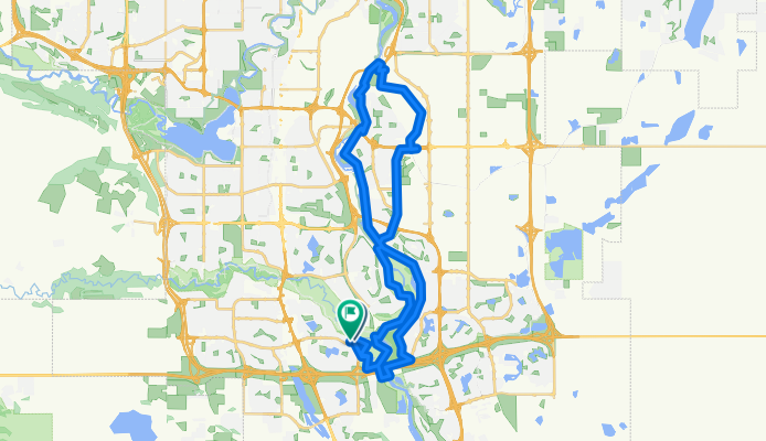
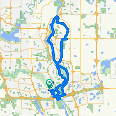
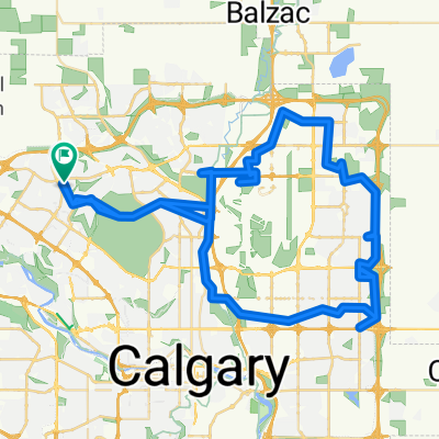
Fish Creek - Stoney Bridge - McKenzie Ridge - Ogden Road - Irrigation Canal - Glenmore Trail - 24th St - Sue Higgins Bridge Loop
A cycling route starting in Calgary, Alberta, Canada.
Overview
About this route
Aug 18, 2025 Ride with Lynne, Lloyd (left us at Eric Harvie Bridge)
- 3 h 16 min
- Duration
- 43.6 km
- Distance
- 188 m
- Ascent
- 176 m
- Descent
- 13.4 km/h
- Avg. speed
- 1,044 m
- Max. altitude

Route quality
Waytypes & surfaces along the route
Waytypes
Cycleway
29.6 km
(68 %)
Quiet road
7 km
(16 %)
Surfaces
Paved
37.5 km
(86 %)
Unpaved
0.9 km
(2 %)
Asphalt
32.3 km
(74 %)
Paved (undefined)
4.8 km
(11 %)
Continue with Bikemap
Use, edit, or download this cycling route
You would like to ride Fish Creek - Stoney Bridge - McKenzie Ridge - Ogden Road - Irrigation Canal - Glenmore Trail - 24th St - Sue Higgins Bridge Loop or customize it for your own trip? Here is what you can do with this Bikemap route:
Free features
- Save this route as favorite or in collections
- Copy & plan your own version of this route
- Sync your route with Garmin or Wahoo
Premium features
Free trial for 3 days, or one-time payment. More about Bikemap Premium.
- Navigate this route on iOS & Android
- Export a GPX / KML file of this route
- Create your custom printout (try it for free)
- Download this route for offline navigation
Discover more Premium features.
Get Bikemap PremiumFrom our community
Other popular routes starting in Calgary
 Route 2
- Distance
- 17.5 km
- Ascent
- 146 m
- Descent
- 52 m
- Location
- Calgary, Alberta, Canada
 18k BakerPk Bow River loop
- Distance
- 17.9 km
- Ascent
- 117 m
- Descent
- 117 m
- Location
- Calgary, Alberta, Canada
 Return ride to Bragg Creek
- Distance
- 79.9 km
- Ascent
- 422 m
- Descent
- 425 m
- Location
- Calgary, Alberta, Canada
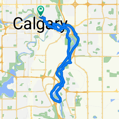 Crescent Heights - Bow River South 30K
- Distance
- 32.9 km
- Ascent
- 121 m
- Descent
- 122 m
- Location
- Calgary, Alberta, Canada
 leg 2
leg 2- Distance
- 14.3 km
- Ascent
- 548 m
- Descent
- 399 m
- Location
- Calgary, Alberta, Canada
 Fish Creek - Stoney Bridge - McKenzie Ridge - Ogden Road - Irrigation Canal - Glenmore Trail - 24th St - Sue Higgins Bridge Loop
- Distance
- 43.6 km
- Ascent
- 188 m
- Descent
- 176 m
- Location
- Calgary, Alberta, Canada
 37th/Leighton Centre Loop
- Distance
- 42.9 km
- Ascent
- 506 m
- Descent
- 508 m
- Location
- Calgary, Alberta, Canada
 20250928 RCSS start to NE Loop ACE Casino Rev 0
- Distance
- 81.4 km
- Ascent
- 444 m
- Descent
- 447 m
- Location
- Calgary, Alberta, Canada
Open it in the app