

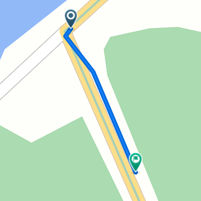
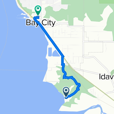
Bay City to Main St, Bay City
A cycling route starting in Bay City, Oregon, United States.
Overview
About this route
- 1 h 9 min
- Duration
- 5.8 km
- Distance
- 44 m
- Ascent
- 31 m
- Descent
- 5 km/h
- Avg. speed
- 28 m
- Max. altitude

Route photos


Continue with Bikemap
Use, edit, or download this cycling route
You would like to ride Bay City to Main St, Bay City or customize it for your own trip? Here is what you can do with this Bikemap route:
Free features
- Save this route as favorite or in collections
- Copy & plan your own version of this route
- Sync your route with Garmin or Wahoo
Premium features
Free trial for 3 days, or one-time payment. More about Bikemap Premium.
- Navigate this route on iOS & Android
- Export a GPX / KML file of this route
- Create your custom printout (try it for free)
- Download this route for offline navigation
Discover more Premium features.
Get Bikemap PremiumFrom our community
Other popular routes starting in Bay City
 test
test- Distance
- 0.1 km
- Ascent
- 0 m
- Descent
- 0 m
- Location
- Bay City, Oregon, United States
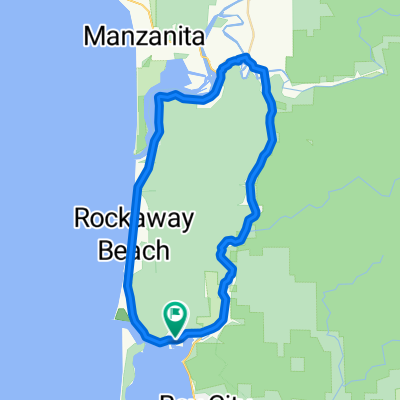 Garibaldi // Nehalem
- Distance
- 45.7 km
- Ascent
- 654 m
- Descent
- 654 m
- Location
- Bay City, Oregon, United States
 45.489° N -123.965° W to 45.489° N -123.965° W
- Distance
- 13.1 km
- Ascent
- 340 m
- Descent
- 338 m
- Location
- Bay City, Oregon, United States
 test 2
- Distance
- 3.2 km
- Ascent
- 220 m
- Descent
- 56 m
- Location
- Bay City, Oregon, United States
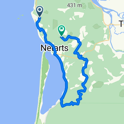 Loop 1
- Distance
- 24.3 km
- Ascent
- 377 m
- Descent
- 346 m
- Location
- Bay City, Oregon, United States
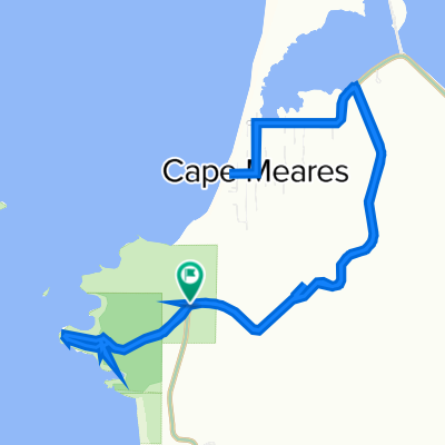
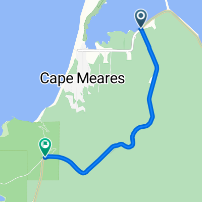 Cape Meares
- Distance
- 3.2 km
- Ascent
- 242 m
- Descent
- 78 m
- Location
- Bay City, Oregon, United States
 iDay 14
- Distance
- 48.3 km
- Ascent
- 264 m
- Descent
- 171 m
- Location
- Bay City, Oregon, United States
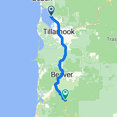
 Tillamook to 9335 Fourth St, Bay City
- Distance
- 3.1 km
- Ascent
- 10 m
- Descent
- 13 m
- Location
- Bay City, Oregon, United States
Open it in the app