
De Väg Utan Namn à Fallanveien
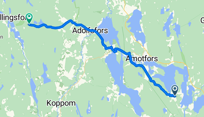
Åmotfors - Charlottenberg
A cycling route starting in Åmotfors, Värmland County, Sweden.
Overview
About this route
- 1 h 52 min
- Duration
- 30.1 km
- Distance
- 510 m
- Ascent
- 427 m
- Descent
- 16 km/h
- Avg. speed
- 202 m
- Max. altitude

Part of
De Väg Utan Namn à Fallanveien
5 stages
Route quality
Waytypes & surfaces along the route
Waytypes
Road
14.7 km
(49 %)
Quiet road
11.7 km
(39 %)
Surfaces
Paved
16.5 km
(55 %)
Asphalt
16.5 km
(55 %)
Undefined
13.5 km
(45 %)
Continue with Bikemap
Use, edit, or download this cycling route
You would like to ride Åmotfors - Charlottenberg or customize it for your own trip? Here is what you can do with this Bikemap route:
Free features
- Save this route as favorite or in collections
- Copy & plan your own version of this route
- Sync your route with Garmin or Wahoo
Premium features
Free trial for 3 days, or one-time payment. More about Bikemap Premium.
- Navigate this route on iOS & Android
- Export a GPX / KML file of this route
- Create your custom printout (try it for free)
- Download this route for offline navigation
Discover more Premium features.
Get Bikemap PremiumFrom our community
Other popular routes starting in Åmotfors
 31.7.2011
- Distance
- 111.2 km
- Ascent
- 369 m
- Descent
- 416 m
- Location
- Åmotfors, Värmland County, Sweden
 Värmland 4. Etappe
- Distance
- 28.4 km
- Ascent
- 218 m
- Descent
- 266 m
- Location
- Åmotfors, Värmland County, Sweden
 Järvens väg 11, Gunnarskog to Gustaf Adolfs torg 1, Göteborg
- Distance
- 300.4 km
- Ascent
- 2,625 m
- Descent
- 2,715 m
- Location
- Åmotfors, Värmland County, Sweden
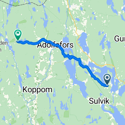
- Stora Årbotten Haget, Gunnarskog to Eda, Charlottenberg
- Distance
- 30.1 km
- Ascent
- 389 m
- Descent
- 395 m
- Location
- Åmotfors, Värmland County, Sweden
 Ånnebol - Akkers brygga
- Distance
- 122.4 km
- Ascent
- 600 m
- Descent
- 725 m
- Location
- Åmotfors, Värmland County, Sweden
 Åmotfors - Charlottenberg
- Distance
- 30.1 km
- Ascent
- 510 m
- Descent
- 427 m
- Location
- Åmotfors, Värmland County, Sweden
 dzień jedenasty
- Distance
- 104 km
- Ascent
- 406 m
- Descent
- 376 m
- Location
- Åmotfors, Värmland County, Sweden
 Arboten (SVE)-Magnor (NOR)
- Distance
- 39.3 km
- Ascent
- 365 m
- Descent
- 360 m
- Location
- Åmotfors, Värmland County, Sweden
Open it in the app