
De Väg Utan Namn à Fallanveien
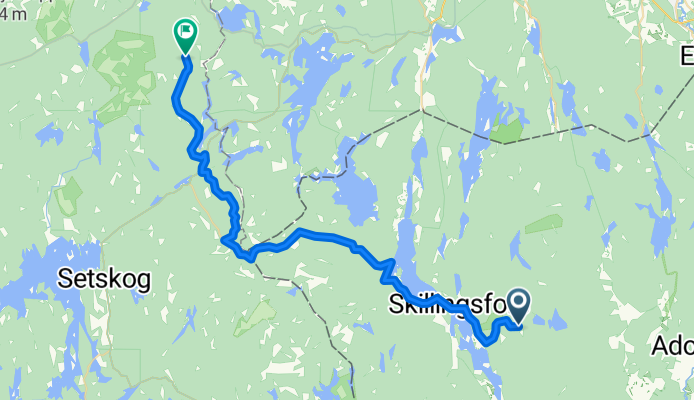
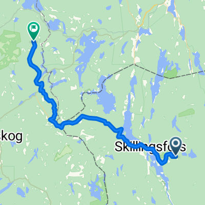
Charlottenberg - Bjørkelangen
A cycling route starting in Charlottenberg, Värmland County, Sweden.
Overview
About this route
- 1 h 58 min
- Duration
- 31 km
- Distance
- 570 m
- Ascent
- 485 m
- Descent
- 15.8 km/h
- Avg. speed
- 310 m
- Max. altitude

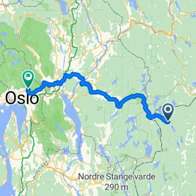
Part of
De Väg Utan Namn à Fallanveien
5 stages
Route quality
Waytypes & surfaces along the route
Waytypes
Quiet road
17.3 km
(56 %)
Road
11.1 km
(36 %)
Surfaces
Paved
11.8 km
(38 %)
Unpaved
13.9 km
(45 %)
Asphalt
11.8 km
(38 %)
Unpaved (undefined)
7.1 km
(23 %)
Continue with Bikemap
Use, edit, or download this cycling route
You would like to ride Charlottenberg - Bjørkelangen or customize it for your own trip? Here is what you can do with this Bikemap route:
Free features
- Save this route as favorite or in collections
- Copy & plan your own version of this route
- Sync your route with Garmin or Wahoo
Premium features
Free trial for 3 days, or one-time payment. More about Bikemap Premium.
- Navigate this route on iOS & Android
- Export a GPX / KML file of this route
- Create your custom printout (try it for free)
- Download this route for offline navigation
Discover more Premium features.
Get Bikemap PremiumFrom our community
Other popular routes starting in Charlottenberg
 De Bönnäset à Fallanveien
- Distance
- 112.7 km
- Ascent
- 1,480 m
- Descent
- 1,443 m
- Location
- Charlottenberg, Värmland County, Sweden
 Charlottenberg - Bjørkelangen
- Distance
- 31 km
- Ascent
- 570 m
- Descent
- 485 m
- Location
- Charlottenberg, Värmland County, Sweden
 Charlottenberg-Kongsv
- Distance
- 45.8 km
- Ascent
- 215 m
- Descent
- 193 m
- Location
- Charlottenberg, Värmland County, Sweden
 Route von Gunnerud Brobacka 1, Skillingsfors
- Distance
- 2.1 km
- Ascent
- 23 m
- Descent
- 30 m
- Location
- Charlottenberg, Värmland County, Sweden
 Från Håvilsrud till Austmarka över Mitanderfors till Håvilsrud
- Distance
- 50.5 km
- Ascent
- 246 m
- Descent
- 244 m
- Location
- Charlottenberg, Värmland County, Sweden
 Rangvald-Carola
- Distance
- 27.8 km
- Ascent
- 358 m
- Descent
- 380 m
- Location
- Charlottenberg, Värmland County, Sweden
 2. Magnor-Sunne 73 km
- Distance
- 72.7 km
- Ascent
- 430 m
- Descent
- 494 m
- Location
- Charlottenberg, Värmland County, Sweden
 Värmland 5. Etappe
- Distance
- 42.7 km
- Ascent
- 322 m
- Descent
- 232 m
- Location
- Charlottenberg, Värmland County, Sweden
Open it in the app